Latitude: 52.0933 / 52°5'35"N
Longitude: 0.5643 / 0°33'51"E
OS Eastings: 575758
OS Northings: 246981
OS Grid: TL757469
Mapcode National: GBR PF6.RH3
Mapcode Global: VHJHC.QNN5
Plus Code: 9F423HV7+8P
Entry Name: Granary to Home Farm
Listing Date: 20 May 1974
Grade: II
Source: Historic England
Source ID: 1194585
English Heritage Legacy ID: 282964
ID on this website: 101194585
Location: Chilton Street, West Suffolk, CO10
County: Suffolk
District: West Suffolk
Civil Parish: Clare
Traditional County: Suffolk
Lieutenancy Area (Ceremonial County): Suffolk
Church of England Parish: Clare with Poslingford
Church of England Diocese: St.Edmundsbury and Ipswich
Tagged with: Granary
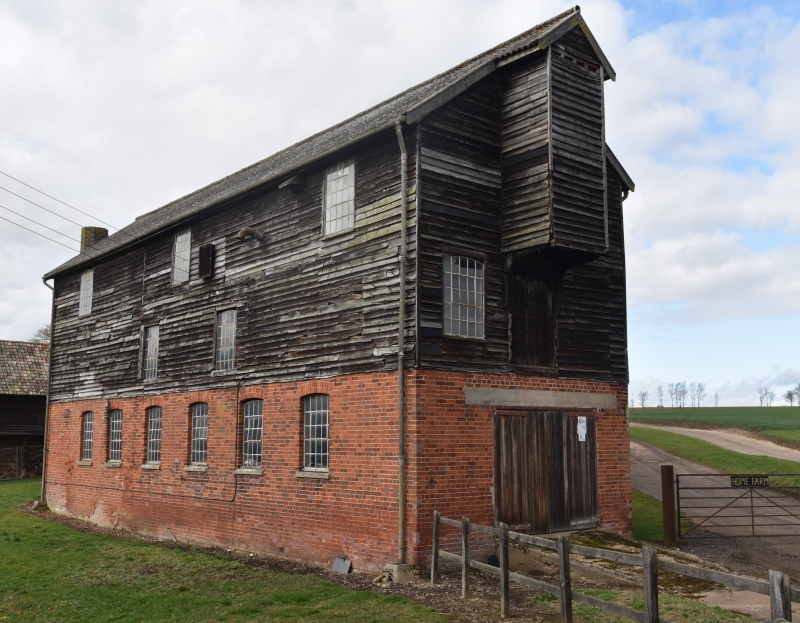
1. CLARE CLARE
2006 Chilton Street
Granary to Home Farm
TL 74 NE 12/590
II
2.
An early C19 timber-framed and weatherboarded building on a random stone base.
3 storeys. The windows have fixed lights with glazing bars in small panes.
There is a loft hoist at the east end. Roof slate.
Listing NGR: TL7575846981
External links are from the relevant listing authority and, where applicable, Wikidata. Wikidata IDs may be related buildings as well as this specific building. If you want to add or update a link, you will need to do so by editing the Wikidata entry.


Other nearby listed buildings