Latitude: 54.0324 / 54°1'56"N
Longitude: -2.8031 / 2°48'11"W
OS Eastings: 347491
OS Northings: 459895
OS Grid: SD474598
Mapcode National: GBR 8PVT.X8
Mapcode Global: WH846.XXB3
Plus Code: 9C6V25JW+WP
Entry Name: Barn at Royal Albert Farm, Royal Albert Hospital
Listing Date: 13 March 1995
Grade: II
Source: Historic England
Source ID: 1194931
English Heritage Legacy ID: 383044
ID on this website: 101194931
Location: The Greaves, Lancaster, Lancashire, LA1
County: Lancashire
District: Lancaster
Electoral Ward/Division: Scotforth West
Parish: Non Civil Parish
Built-Up Area: Lancaster
Traditional County: Lancashire
Lieutenancy Area (Ceremonial County): Lancashire
Church of England Parish: Lancaster St Paul
Church of England Diocese: Blackburn
Tagged with: Barn
LANCASTER
SD45NE ASHTON ROAD 1685-1/2/346 (West side) Barn at Royal Albert Farm, Royal Albert Hospital
GV II
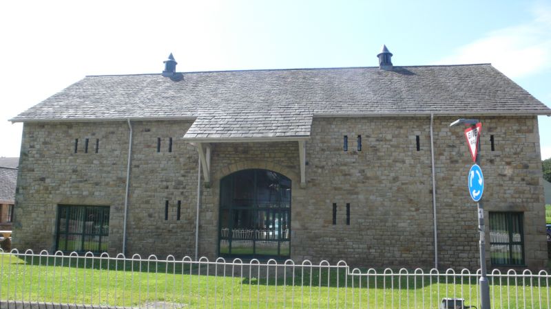
Farm building. Late C19. Probably by Paley and Austin. Squared coursed sandstone rubble with green slate roof. The central cart entrance, in the east wall, has a segmental arch and surround of rock-faced sandstone. The roof is carried down over the entrance as a slated canopy on timber brackets. There are 2 rows of slit vents, a blocked wide entrance with plain lintel towards the left, and a doorway at the right. On the ridge are 2 metal ventilators. The north and south walls have pitching holes under their gables. A lean-to against the west wall has been demolished following fire damage and the openings blocked with brickwork. HISTORY: built as part of the ancillary buildings to the Royal Albert Idiot Asylum, now the Royal Albert Hospital (qv), which was completed in 1873.
Listing NGR: SD4749159895
External links are from the relevant listing authority and, where applicable, Wikidata. Wikidata IDs may be related buildings as well as this specific building. If you want to add or update a link, you will need to do so by editing the Wikidata entry.


Other nearby listed buildings