Latitude: 52.7531 / 52°45'11"N
Longitude: 0.3939 / 0°23'38"E
OS Eastings: 561659
OS Northings: 319959
OS Grid: TF616199
Mapcode National: GBR N3Q.JD2
Mapcode Global: WHJP7.02V8
Plus Code: 9F42Q93V+6H
Entry Name: 15, Queen Street
Listing Date: 4 December 1970
Last Amended: 26 July 1993
Grade: II
Source: Historic England
Source ID: 1195416
English Heritage Legacy ID: 384243
ID on this website: 101195416
Location: King's Lynn, King's Lynn and West Norfolk, Norfolk, PE30
County: Norfolk
District: King's Lynn and West Norfolk
Electoral Ward/Division: St Margarets with St Nicholas
Parish: Non Civil Parish
Built-Up Area: King's Lynn
Traditional County: Norfolk
Lieutenancy Area (Ceremonial County): Norfolk
Tagged with: Building
KING'S LYNN
TF6119NE QUEEN STREET 610-1/9/176 (West side) 04/12/70 No.15 (Formerly Listed as: QUEEN STREET (West side) No.15 and Warehouse at rear of No 15)
GV II
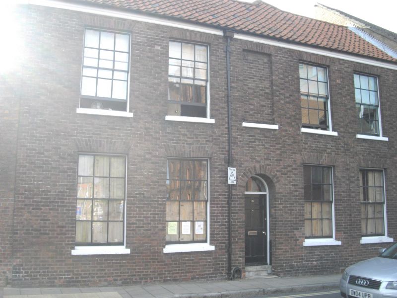
House. Early C18 and early C19. Early C18 red brick rear with early C19 red brick front. Pantile roofs. T-plan formed by gabled rear wing right of centre. Gabled wing abutting to south and extending down King's Staithe Lane is not part of this house plan. Facade of 2 storeys in 5 bays. Central panelled door under plain fanlight. Above is a blind window. Fenestration of sashes with glazing bars and gauged skewback arches. Gabled roof with stack on rear slope. West end of rear wing shows evidence of heightening in early C19. Early C18 stepped external stack.
Listing NGR: TF6165919959
External links are from the relevant listing authority and, where applicable, Wikidata. Wikidata IDs may be related buildings as well as this specific building. If you want to add or update a link, you will need to do so by editing the Wikidata entry.


Other nearby listed buildings