Latitude: 53.0056 / 53°0'20"N
Longitude: -2.2036 / 2°12'13"W
OS Eastings: 386432
OS Northings: 345381
OS Grid: SJ864453
Mapcode National: GBR MDK.K3
Mapcode Global: WHBCT.3QX7
Plus Code: 9C5V2Q4W+6G
Entry Name: Hartshill Cemetery Chapels
Listing Date: 15 March 1993
Grade: II
Source: Historic England
Source ID: 1195841
English Heritage Legacy ID: 384473
ID on this website: 101195841
Location: Stoke Cemetery, Hartshill, Stoke-on-Trent, Staffordshire, ST4
County: City of Stoke-on-Trent
Electoral Ward/Division: Penkhull and Stoke
Parish: Non Civil Parish
Built-Up Area: Stoke-on-Trent
Traditional County: Staffordshire
Lieutenancy Area (Ceremonial County): Staffordshire
Church of England Parish: Hartshill
Church of England Diocese: Lichfield
Tagged with: Chapel Cemetery chapel
STOKE ON TRENT
SJ8645SE QUEEN'S ROAD, Hartshill 613-1/9/69 (West side) Hartshill Cemetery Chapels
II
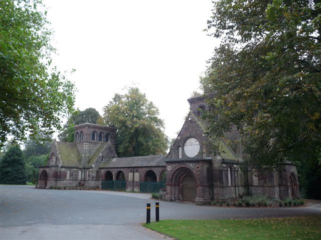
Cemetery chapels. c1850. By Charles Lynam. Brick with plain tiled roofs. Romanesque style, symmetrically arranged, with chapels linked by central arcade. Chapels each have central tower clasped by gabled ranges on 2 sides with blank arcading and corbel table. Eastern gabled range has projecting flat-roofed porch with round-arched entrance. Rose window over porch. Paired round-arched windows in side elevation, and in return range linking with central arcade. Continuous stone and moulded brick sill bands, and brick corbel table. Central arcade of 4 bays, round arches carried on shafts, with flat roof over.
Listing NGR: SJ8643245381
External links are from the relevant listing authority and, where applicable, Wikidata. Wikidata IDs may be related buildings as well as this specific building. If you want to add or update a link, you will need to do so by editing the Wikidata entry.


Other nearby listed buildings