Latitude: 50.1031 / 50°6'10"N
Longitude: -5.2763 / 5°16'34"W
OS Eastings: 165812
OS Northings: 27692
OS Grid: SW658276
Mapcode National: GBR Z1.0P2H
Mapcode Global: VH133.HNHW
Plus Code: 9C2P4P3F+6F
Entry Name: The Andrew Hall
Listing Date: 22 May 1972
Last Amended: 9 February 1994
Grade: II
Source: Historic England
Source ID: 1196332
English Heritage Legacy ID: 385402
ID on this website: 101196332
Location: Helston, Cornwall, TR13
County: Cornwall
Civil Parish: Helston
Built-Up Area: Helston
Traditional County: Cornwall
Lieutenancy Area (Ceremonial County): Cornwall
Church of England Parish: Helston
Church of England Diocese: Truro
Tagged with: Architectural structure
HELSTON
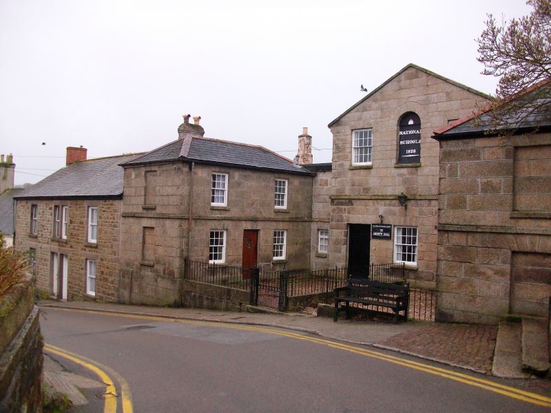
SW6427 CHURCH STREET 631-1/4/51 (West side) 22/05/72 The Andrew Hall (Formerly Listed as: CHURCH STREET (West side) Old National Schools)
GV II
Also known as: Old National School CHURCH STREET. National school, now hall. Datestone 1828. Granite ashlar front with plinth, flat arches and mid-floor string; asbestos slate roof with coped front gable. Deep plan. 2 storeys; symmetrical 3-bay entrance gable front. Original 16-pane hornless sashes to 1st floor left and right and ground-floor centre flanked by 2 doorways with original 6-panel doors; central round-arched 1st-floor niche inscribed NATIONAL SCHOOLS 1828. C20 matching linking structure set back on left. INTERIOR not inspected. Part of a fine and remarkably complete group including the schoolhouses (qv) flanking and the railings (qv) enclosing the front yard.
Listing NGR: SW6581227692
External links are from the relevant listing authority and, where applicable, Wikidata. Wikidata IDs may be related buildings as well as this specific building. If you want to add or update a link, you will need to do so by editing the Wikidata entry.


Other nearby listed buildings