Latitude: 53.7378 / 53°44'16"N
Longitude: -2.9542 / 2°57'15"W
OS Eastings: 337156
OS Northings: 427247
OS Grid: SD371272
Mapcode National: GBR 7TT6.6V
Mapcode Global: WH85P.L9GW
Plus Code: 9C5VP2QW+48
Entry Name: 47-51, Warton Street
Listing Date: 15 February 1993
Grade: II
Source: Historic England
Source ID: 1196342
English Heritage Legacy ID: 385321
ID on this website: 101196342
Location: Lytham, Fylde, Lancashire, FY8
County: Lancashire
District: Fylde
Electoral Ward/Division: Clifton
Parish: Lytham
Built-Up Area: Lytham St Anne's
Traditional County: Lancashire
Lieutenancy Area (Ceremonial County): Lancashire
Church of England Parish: Lytham St John the Divine
Church of England Diocese: Blackburn
Tagged with: Building
LYTHAM ST ANNES
SD3727 WARTON STREET, Lytham 621-1/4/90 (North side) Nos.47, 49 AND 51
II
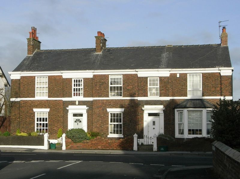
Terrace of 3 small town houses. c.1850-60. Brown brick in Flemish bond (sides and rear in English garden wall bond), with sandstone dressings and slate roof. Double-depth plan, each house single-fronted, with back extensions. Two storeys, 2+2+1 windows, the 2nd and 4th bays breaking forwards slightly, with corner pilasters, frieze and cornice. The 2nd and 4th bays have doorways to Nos 47 & 49, with pilastered architraves and moulded cornices, and altered doors with overlights. No.51 has a single-storey cross-gabled porch to the right-hand return wall, and a canted bay window to the front; otherwise, all have are unhorned 12-pane sashed windows. Similar windows at rear.
Listing NGR: SD3715627247
External links are from the relevant listing authority and, where applicable, Wikidata. Wikidata IDs may be related buildings as well as this specific building. If you want to add or update a link, you will need to do so by editing the Wikidata entry.


Other nearby listed buildings