Latitude: 54.8936 / 54°53'36"N
Longitude: -2.9385 / 2°56'18"W
OS Eastings: 339902
OS Northings: 555829
OS Grid: NY399558
Mapcode National: GBR 7CXV.ML
Mapcode Global: WH802.T8WC
Plus Code: 9C6VV3V6+CH
Entry Name: West City Walls
Listing Date: 1 June 1949
Last Amended: 11 April 1994
Grade: I
Source: Historic England
Source ID: 1197151
English Heritage Legacy ID: 386918
ID on this website: 101197151
Location: Carlisle, Cumberland, Cumbria, CA3
County: Cumberland
District: Carlisle
Parish: Non Civil Parish
Built-Up Area: Carlisle
Traditional County: Cumberland
Lieutenancy Area (Ceremonial County): Cumbria
Church of England Parish: Carlisle St Cuthbert with St Mary
Church of England Diocese: Carlisle
Tagged with: City walls
CARLISLE
NY3955NE WEST WALLS 671-1/10/310 (West side) 01/06/49 West City Walls (Formerly Listed as: Remains of City Walls at West Walls)
GV I
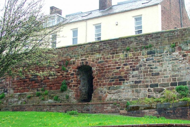
City walls. C12 with extensive rebuilding and refacing of 1746, 1876-7, 1985, 1988-9. Squared blocks of red sandstone with some calciferous sandstone (some re-used Roman stone), partly with chamfered plinth and partly battered. Gently curving wall which projects at its northern end, built against a river terrace as a retaining wall; the West Walls street is at the higher level behind and the pavement forms the parapet walk along the wall. The northern projection was rebuilt or refaced in 1876-7, when the nearby railway was re-aligned; set into the end of this part of the wall is the inscription stone WEST WALLS. Off-centre external stone steps to the Town Dyke Orchard were added in 1883; the parapet between the steps and the projection was rebuilt in new red sandstone in 1985. Further south a number of buildings were constructed against the wall and these were demolished in 1988; the wall behind needed partial rebuilding and this was done with red sandstone from the demolished buildings. The foundation stone from each demolished building was incorporated; THE FAWCETT SCHOOLS (dated 1851 in Roman numerals); the mayor and date 1879 for the police station extension, the mayor and date 1840 for the police station; recording the restoration, a stone with the mayor's name and date 1988, the unveiling was on 21 April 1989. At southern end of the exposed wall are the Sallyport steps which were added c1813 and nearby is the medieval sallyport opening, now merely an arched recess. The wall continues beyond the Sallyport steps, but is concealed by buildings; for the listing of the remainder of the wall to the south see Nos 10-22 West Walls (qv) and for the northernmost stretch see under Carlisle Castle (qv). For an engraving of the West Walls when complete in 1745 by the Buck Brothers, see J Cornforth, Country Life, (1978).
Listing NGR: NY3990255828
External links are from the relevant listing authority and, where applicable, Wikidata. Wikidata IDs may be related buildings as well as this specific building. If you want to add or update a link, you will need to do so by editing the Wikidata entry.


Other nearby listed buildings