Latitude: 53.4847 / 53°29'4"N
Longitude: -2.2448 / 2°14'41"W
OS Eastings: 383849
OS Northings: 398687
OS Grid: SJ838986
Mapcode National: GBR DJF.LV
Mapcode Global: WHB9G.HN7Y
Plus Code: 9C5VFQM4+V3
Entry Name: Mynshulls House
Listing Date: 20 June 1988
Grade: II
Source: Historic England
Source ID: 1197779
English Heritage Legacy ID: 387969
ID on this website: 101197779
Location: City Centre, Manchester, Greater Manchester, M3
County: Manchester
Electoral Ward/Division: City Centre
Parish: Non Civil Parish
Built-Up Area: Manchester
Traditional County: Lancashire
Lieutenancy Area (Ceremonial County): Greater Manchester
Church of England Parish: Manchester Cathedral
Church of England Diocese: Manchester
Tagged with: House
MANCHESTER
SJ8398NE CATEATON STREET 698-1/26/40 (North side) 20/06/88 No.14 Mynshull's House
GV II
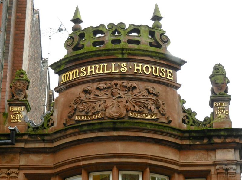
Offices over shop. Dated 1890; by William Ball and Thomas Brookes Elce, with carvings by J.Jarvis Millson; altered slightly at ground floor. Red sandstone with some moulded terracotta in matching colour; roof concealed. Narrow rectangular plan at right-angles to street, occupying part of island site with one side to passage known as Hanging Bridge. Jacobean style. Three low storeys and one bay; carved consoles to moulded frieze over ground floor; central segmental bow above this with 6-light mullioned windows flanked by pairs of small Ionic pilasters, a wide lettered cartouche on the bowed panel between the windows, cornices over both floors, and a large bowed upstand with terracotta foliation, frieze lettered "MYNSHULL'S HOUSE" and Jacobean-style strap-work cresting with obelisk finials, flanked by lions with shields on lettered pedestals. Return side similar but simpler.
Listing NGR: SJ8385098688
External links are from the relevant listing authority and, where applicable, Wikidata. Wikidata IDs may be related buildings as well as this specific building. If you want to add or update a link, you will need to do so by editing the Wikidata entry.


Other nearby listed buildings