Latitude: 51.8733 / 51°52'23"N
Longitude: -1.4816 / 1°28'53"W
OS Eastings: 435787
OS Northings: 219543
OS Grid: SP357195
Mapcode National: GBR 6TM.J78
Mapcode Global: VHBZP.85LR
Plus Code: 9C3WVGF9+89
Entry Name: 1, Browns Lane
Listing Date: 18 May 1990
Grade: II
Source: Historic England
Source ID: 1198129
English Heritage Legacy ID: 254159
ID on this website: 101198129
Location: Charlbury, West Oxfordshire, OX7
County: Oxfordshire
District: West Oxfordshire
Civil Parish: Charlbury
Built-Up Area: Charlbury
Traditional County: Oxfordshire
Lieutenancy Area (Ceremonial County): Oxfordshire
Church of England Parish: Charlbury with Shorthampton
Church of England Diocese: Oxford
Tagged with: Building
CHARLBURY BROWN'S LANE SP3519 5/19 (South-East side) No 1 GV II
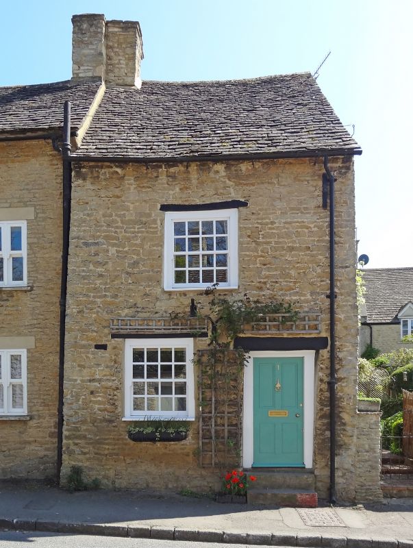
House. Probably mid C18. Coursed squared limestone rubble, stone slate roof. Single-unit plan. 2 storeys and gable-lit attic; one window range. 2 steps up to 4-panelled C19 door to right under heavy stop-chamfered lintel. Sash window with glazing bars to left, similar window in centre of first floor under stop-chamfered lintel. C20 attic window in right gable; stack to left. This small building is situated opposite Heathfield Cottage and occupies a conspicuous position in the approach to the Playing Close (q.v)
Listing NGR: SP3578819544
External links are from the relevant listing authority and, where applicable, Wikidata. Wikidata IDs may be related buildings as well as this specific building. If you want to add or update a link, you will need to do so by editing the Wikidata entry.


Other nearby listed buildings