Latitude: 51.8719 / 51°52'18"N
Longitude: -1.481 / 1°28'51"W
OS Eastings: 435825
OS Northings: 219390
OS Grid: SP358193
Mapcode National: GBR 6TM.QC2
Mapcode Global: VHBZP.86WT
Plus Code: 9C3WVGC9+QH
Entry Name: The Farmers Public House
Listing Date: 18 May 1990
Grade: II
Source: Historic England
Source ID: 1198486
English Heritage Legacy ID: 254238
ID on this website: 101198486
Location: Charlbury, West Oxfordshire, OX7
County: Oxfordshire
District: West Oxfordshire
Civil Parish: Charlbury
Built-Up Area: Charlbury
Traditional County: Oxfordshire
Lieutenancy Area (Ceremonial County): Oxfordshire
Church of England Parish: Charlbury with Shorthampton
Church of England Diocese: Oxford
Tagged with: Pub
CHARLBURY SHEEP STREET SP3519 5/95 (East side) The Farmers Public House GV II
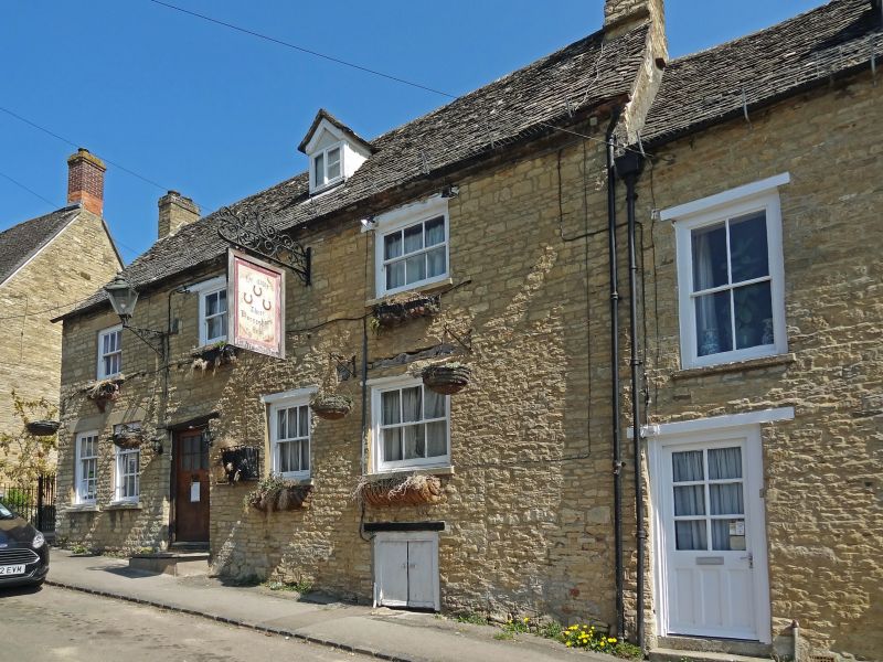
House, now public house. C18 or earlier. Coursed squared rubble; timber lintels; C19/C20 brick gable to left, 2 brick chimneys; stone slate roof. 2 storeys, cellar and attic. 3-window range of sashes with glazing bars and horns. Left part rebuilt with concrete lintels. Central C20 part- glazed door; low plank door to cellar on right. Insurance plaque. One small rendered gabled dormer has fixed window with glazing bars. Interior has roughly chamfered girders and floor joists. Room at rear to right has fireplace with chamfered bressumer.
Listing NGR: SP3582819393
External links are from the relevant listing authority and, where applicable, Wikidata. Wikidata IDs may be related buildings as well as this specific building. If you want to add or update a link, you will need to do so by editing the Wikidata entry.


Other nearby listed buildings