Approximate Location Map
Large Map »
Latitude: 51.5863 / 51°35'10"N
Longitude: -1.4294 / 1°25'45"W
OS Eastings: 439629
OS Northings: 187651
OS Grid: SU396876
Mapcode National: GBR 6Y5.KFR
Mapcode Global: VHC12.5DP8
Plus Code: 9C3WHHPC+G6
Entry Name: Wall Approximately 20 Metres South of King Alfred's School
Listing Date: 6 December 1985
Grade: II
Source: Historic England
Source ID: 1198777
English Heritage Legacy ID: 251250
ID on this website: 101198777
Location: Wantage, Vale of White Horse, Oxfordshire, OX12
County: Oxfordshire
District: Vale of White Horse
Civil Parish: Wantage
Built-Up Area: Wantage
Traditional County: Berkshire
Lieutenancy Area (Ceremonial County): Oxfordshire
Tagged with: Wall
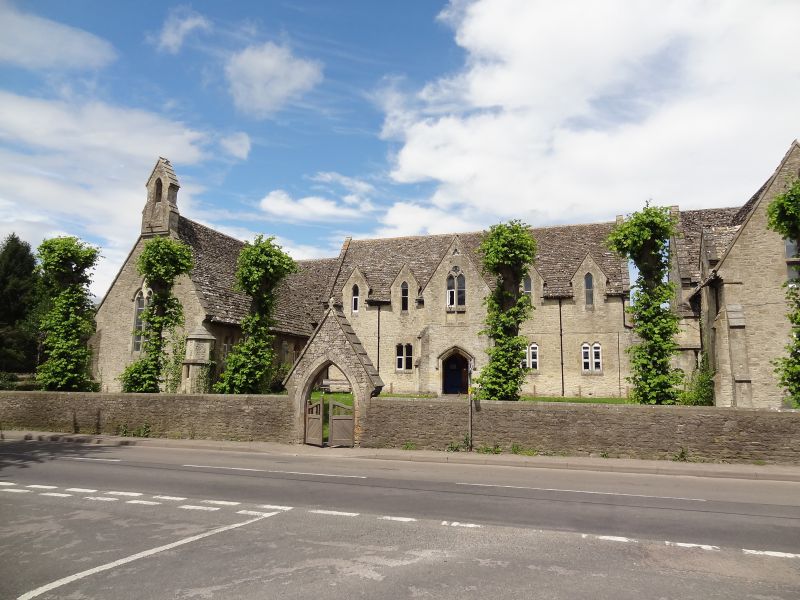
WANTAGE PORTWAY
SU3987 (North side)
7/151 Wall approx. 20m. S of King
Alfred's School
GV II
Wall. c1849-50. Coursed limestone rubble with limestone ashlar coping; pointed
moulded arch to gabled entry with stepped coping stones and moulded kneelers.
Included for group value.
Listing NGR: SU3962987651
External links are from the relevant listing authority and, where applicable, Wikidata. Wikidata IDs may be related buildings as well as this specific building. If you want to add or update a link, you will need to do so by editing the Wikidata entry.


Other nearby listed buildings
