Approximate Location Map
Large Map »
Latitude: 51.7494 / 51°44'57"N
Longitude: -1.2547 / 1°15'16"W
OS Eastings: 451549
OS Northings: 205901
OS Grid: SP515059
Mapcode National: GBR 8Z4.7M3
Mapcode Global: VHCXV.69K6
Plus Code: 9C3WPPXW+Q4
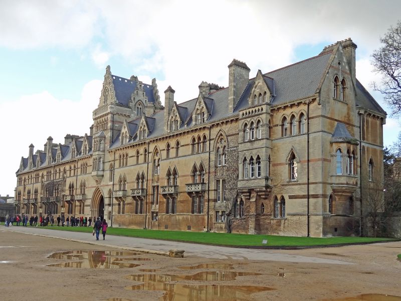
Entry Name: Christchurch, Meadow Buildings
Listing Date: 29 January 1968
Grade: II
Source: Historic England
Source ID: 1198863
English Heritage Legacy ID: 244883
ID on this website: 101198863
Location: Christ Church Cathedral, Oxford, Oxfordshire, OX1
County: Oxfordshire
District: Oxford
Electoral Ward/Division: Holywell
Parish: Non Civil Parish
Built-Up Area: Oxford
Traditional County: Oxfordshire
Lieutenancy Area (Ceremonial County): Oxfordshire
Tagged with: Building
CHRISTCHURCH
1.
1485
Meadow Buildings
SP 5105 NE l3/453H 29.1.68.
II
2.
1862-5 by Thomas Newnham Deane in Box Ground (Bath) stone, Mansfield brick
and Hornton stone dressings.
Listing NGR: SP5154905901
External links are from the relevant listing authority and, where applicable, Wikidata. Wikidata IDs may be related buildings as well as this specific building. If you want to add or update a link, you will need to do so by editing the Wikidata entry.


Other nearby listed buildings
