Latitude: 52.0616 / 52°3'41"N
Longitude: -1.3366 / 1°20'11"W
OS Eastings: 445576
OS Northings: 240569
OS Grid: SP455405
Mapcode National: GBR 7ST.QW2
Mapcode Global: VHCW7.SF7X
Plus Code: 9C4W3M67+M9
Entry Name: The Granary
Listing Date: 7 October 1969
Last Amended: 14 February 1986
Grade: II
Source: Historic England
Source ID: 1199320
English Heritage Legacy ID: 244312
ID on this website: 101199320
Location: Banbury, Cherwell, Oxfordshire, OX16
County: Oxfordshire
District: Cherwell
Civil Parish: Banbury
Built-Up Area: Banbury
Traditional County: Oxfordshire
Lieutenancy Area (Ceremonial County): Oxfordshire
Church of England Parish: Banbury St Mary
Church of England Diocese: Oxford
Tagged with: Granary
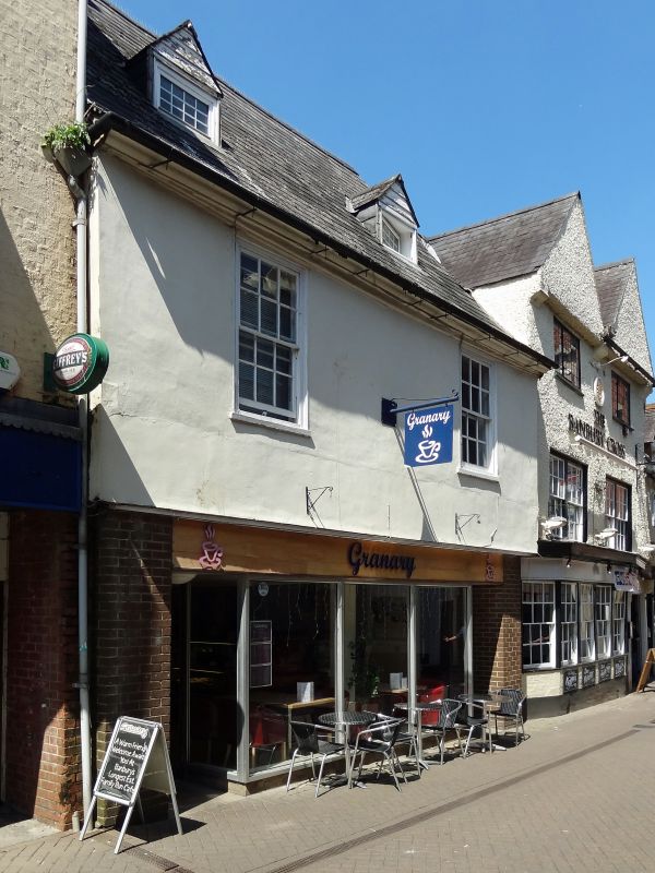
BANBURY BUTCHER'S ROW
SP4540NE (North side)
7/24 No.6 (The Granary)
07/10/69 (Formerly listed as No.6)
GV II
House, now cafe and dwelling. C17 with later alterations. Ground floor rebuilt
C20. Jettied. stuccoed first floor. Steeply pitched slate roof, brick ridge
stack to left. 2 storeys plus attic; 2-window range. C20 front to cafe. 2 sashes
to first floor have moulded wood frames and glazing bars (3-pane width). 2
gabled roof dormers. Moulded wooden eaves cornice. Interior: noted as having
beams in first-floor rooms. Ground floor remodelled C20. Included for group
value.
Listing NGR: SP4557640569
External links are from the relevant listing authority and, where applicable, Wikidata. Wikidata IDs may be related buildings as well as this specific building. If you want to add or update a link, you will need to do so by editing the Wikidata entry.


Other nearby listed buildings