Latitude: 51.6581 / 51°39'29"N
Longitude: -1.5871 / 1°35'13"W
OS Eastings: 428660
OS Northings: 195560
OS Grid: SU286955
Mapcode National: GBR 5VP.TW1
Mapcode Global: VHC0L.FLV8
Plus Code: 9C3WMC57+65
Entry Name: South Elms
Listing Date: 10 July 1986
Grade: II
Source: Historic England
Source ID: 1199378
English Heritage Legacy ID: 249391
ID on this website: 101199378
Location: Faringdon, Vale of White Horse, Oxfordshire, SN7
County: Oxfordshire
District: Vale of White Horse
Civil Parish: Great Faringdon
Built-Up Area: Faringdon
Traditional County: Berkshire
Lieutenancy Area (Ceremonial County): Oxfordshire
Church of England Parish: Faringdon
Church of England Diocese: Oxford
Tagged with: Architectural structure
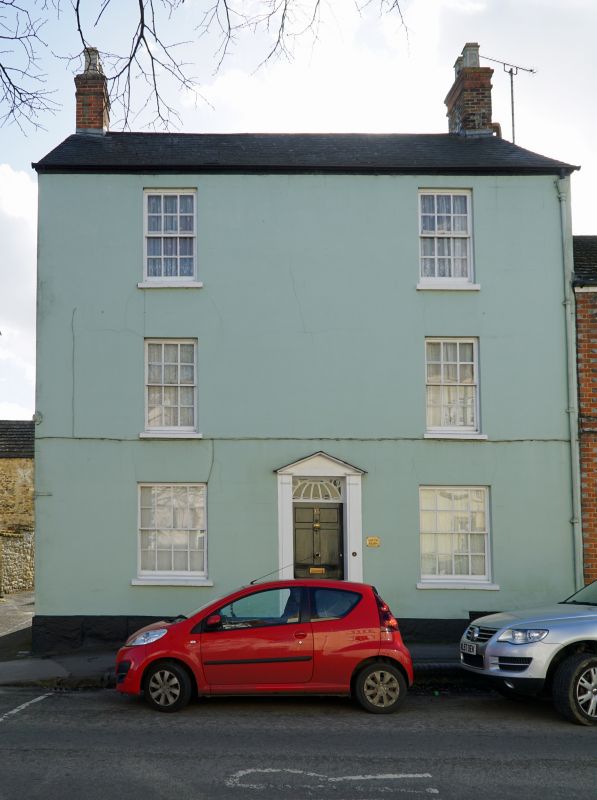
GREAT FARINGDON GLOUCESTER STREET
SU 2895 (south side)
3/29 No 35 (South Elms)
-
- II
Earlier C19 stuccoed house. 3-storey. Slate roof with end wall stacks.
2-window range of glazing bar sashes, 16-pane to ground floor. Stone plinth.
Door with slim pilaster surround and open pedimental hood. Arched head with
metal traceried fanlight.
Listing NGR: SU2866095560
External links are from the relevant listing authority and, where applicable, Wikidata. Wikidata IDs may be related buildings as well as this specific building. If you want to add or update a link, you will need to do so by editing the Wikidata entry.


Other nearby listed buildings