Approximate Location Map
Large Map »
Latitude: 51.4986 / 51°29'55"N
Longitude: -0.1203 / 0°7'13"W
OS Eastings: 530573
OS Northings: 179420
OS Grid: TQ305794
Mapcode National: GBR KJ.4Y
Mapcode Global: VHGQZ.VLRH
Plus Code: 9C3XFVXH+FV
Entry Name: Wall Along Western Boundary of St Thomas' Hospital
Listing Date: 27 March 1981
Grade: II
Source: Historic England
Source ID: 1200667
English Heritage Legacy ID: 203985
ID on this website: 101200667
Location: Lambeth, London, SE1
County: London
District: Lambeth
Electoral Ward/Division: Bishop's
Parish: Non Civil Parish
Built-Up Area: Lambeth
Traditional County: Surrey
Lieutenancy Area (Ceremonial County): Greater London
Church of England Parish: North Lambeth
Church of England Diocese: Southwark
Tagged with: Wall
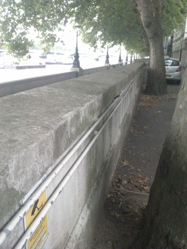
ALBERT EMBANKMENT SE1
1. (east Side)
5023
Wall along western
boundary of
St Thomas' Hospital
TQ 3079 2/22
II
2.
Mid-late C19. Portland stone. Very high roll-moulded plinth, flat buttresses
and cornice. Ramped up at south end to tall, rusticated pier. Pedimented entrance
arch on north return.
Listing NGR: TQ3057379420
External links are from the relevant listing authority and, where applicable, Wikidata. Wikidata IDs may be related buildings as well as this specific building. If you want to add or update a link, you will need to do so by editing the Wikidata entry.


Other nearby listed buildings
