Latitude: 51.8207 / 51°49'14"N
Longitude: -1.6604 / 1°39'37"W
OS Eastings: 423502
OS Northings: 213615
OS Grid: SP235136
Mapcode National: GBR 5SN.T6N
Mapcode Global: VHBZS.5HKM
Plus Code: 9C3WR8CQ+7R
Entry Name: Stone Stile Approximately 15 Metres South of Numbers 31 and 32
Listing Date: 23 October 1978
Last Amended: 21 August 1989
Grade: II
Source: Historic England
Source ID: 1200780
English Heritage Legacy ID: 253713
ID on this website: 101200780
Location: Taynton, West Oxfordshire, OX18
County: Oxfordshire
District: West Oxfordshire
Civil Parish: Taynton
Traditional County: Oxfordshire
Lieutenancy Area (Ceremonial County): Oxfordshire
Church of England Parish: Taynton
Church of England Diocese: Oxford
Tagged with: Architectural structure
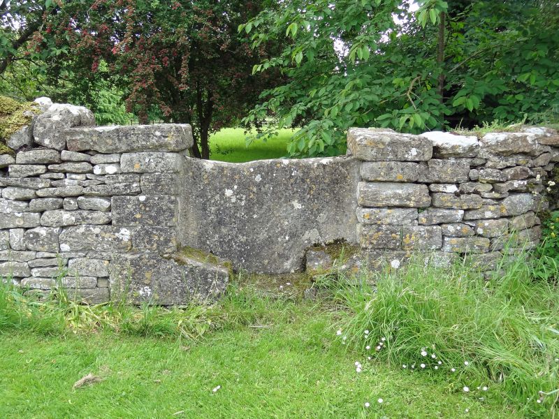
TAYNTON SP2313 10/155 Stone stile approx. 15m S of 23/10/78 Nos.31 and 32 (Formerly listed as Stone stile opposite No.31) GV II
Stile. Probably C19. Stone. Flag-stone on edge with stone quoins to sides shaped to form steps. Attached to dry-stone walls to each side.
Listing NGR: SP2350213615
External links are from the relevant listing authority and, where applicable, Wikidata. Wikidata IDs may be related buildings as well as this specific building. If you want to add or update a link, you will need to do so by editing the Wikidata entry.


Other nearby listed buildings