Approximate Location Map
Large Map »
Latitude: 51.461 / 51°27'39"N
Longitude: -2.6153 / 2°36'55"W
OS Eastings: 357346
OS Northings: 173735
OS Grid: ST573737
Mapcode National: GBR C3H.J4
Mapcode Global: VH88M.MJ7W
Plus Code: 9C3VF96M+9V
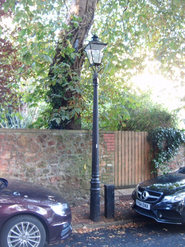
Entry Name: Gas Lamp Post Approximately 15 Metres West of Number 6
Listing Date: 30 December 1994
Grade: II
Source: Historic England
Source ID: 1202031
English Heritage Legacy ID: 379039
ID on this website: 101202031
Location: Clifton, Bristol, BS8
County: City of Bristol
Electoral Ward/Division: Clifton Down
Parish: Non Civil Parish
Built-Up Area: Bristol
Traditional County: Gloucestershire
Lieutenancy Area (Ceremonial County): Bristol
Church of England Parish: Clifton All Saints with St John
Church of England Diocese: Bristol
Tagged with: Gas streetlight
BRISTOL
ST5773NW BUCKINGHAM VALE, Clifton
901-1/2/703 (West side)
Gas lamp post approximately 15
metres west of No.6
GV II
Gas lamp post. Mid C19. Cast-iron. Moulded base to a fluted
shaft, switch bars and square lantern. Converted to
electricity.
Listing NGR: ST5734673735
External links are from the relevant listing authority and, where applicable, Wikidata. Wikidata IDs may be related buildings as well as this specific building. If you want to add or update a link, you will need to do so by editing the Wikidata entry.


Other nearby listed buildings
