Latitude: 51.506 / 51°30'21"N
Longitude: -2.6302 / 2°37'48"W
OS Eastings: 356354
OS Northings: 178752
OS Grid: ST563787
Mapcode National: GBR JP.J732
Mapcode Global: VH88F.CDCV
Plus Code: 9C3VG949+CW
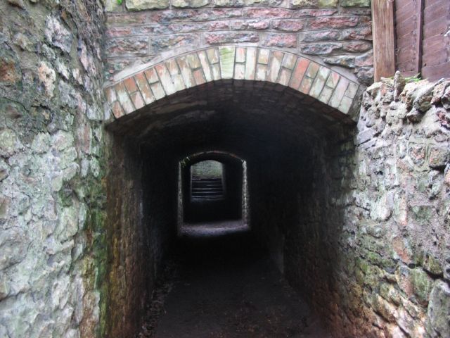
Entry Name: Tunnel from Churchyard of St Mary to South Under Rear Area of the Old Vicarage
Listing Date: 4 March 1977
Last Amended: 30 December 1994
Grade: II
Source: Historic England
Source ID: 1202068
English Heritage Legacy ID: 379141
ID on this website: 101202068
Location: Henbury, Bristol, BS10
County: City of Bristol
Electoral Ward/Division: Henbury and Brentry
Parish: Non Civil Parish
Built-Up Area: Bristol
Traditional County: Gloucestershire
Lieutenancy Area (Ceremonial County): Bristol
Church of England Parish: Henbury
Church of England Diocese: Bristol
Tagged with: Architectural structure
BRISTOL
ST5678NW CHURCH CLOSE, Henbury 901-1/17/1326 Tunnel from Churchyard of St Mary to 04/03/77 S under rear area of The Old Vicarage (Formerly Listed as: RECTORY GARDENS (South side) Tunnel under Vicarage Garden with path from churchyard to Blaise Castle Park)
II
Tunnel. c1835. Rubble, brick arches, copper-slag block coping and Pennant steps. Tunnel with segmental-arched roof, reached by steps down from the churchyard. Built to carry a public footpath below the rear yard of The Old Vicarage.
Listing NGR: ST5635478752
External links are from the relevant listing authority and, where applicable, Wikidata. Wikidata IDs may be related buildings as well as this specific building. If you want to add or update a link, you will need to do so by editing the Wikidata entry.


Other nearby listed buildings