Latitude: 51.2743 / 51°16'27"N
Longitude: 1.2152 / 1°12'54"E
OS Eastings: 624356
OS Northings: 157702
OS Grid: TR243577
Mapcode National: GBR VZS.22G
Mapcode Global: VHLGQ.07TH
Plus Code: 9F3376F8+P3
Entry Name: Former Post Office
Listing Date: 26 November 1987
Grade: II
Source: Historic England
Source ID: 1203536
English Heritage Legacy ID: 178332
ID on this website: 101203536
Location: Wingham, Dover, Kent, CT3
County: Kent
District: Dover
Civil Parish: Wingham
Built-Up Area: Wingham
Traditional County: Kent
Lieutenancy Area (Ceremonial County): Kent
Tagged with: Post office
This list entry was subject to a Minor Amendment on 20 May 2025 to update the Name and Address and reformat the text to current standards
TR 2457
9/300
WINGHAM
HIGH STREET (east side)
No 71
(Formerly listed as Post Office)
GV
II
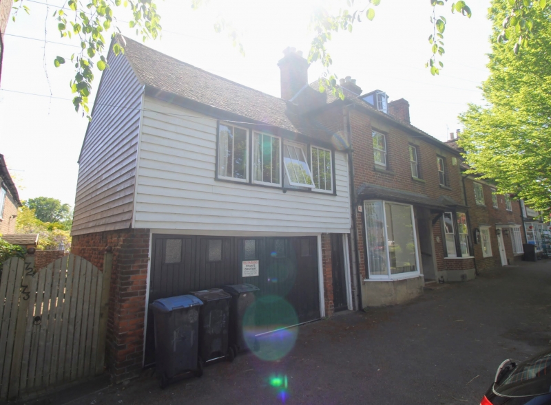
House, now post office. Mid C18 altered mid C19. Red brick with plain tiled roof. Two storeys and attic on plinth with rusticated quoins. Hipped roof with one segmental dormer and stacks to left and to right. Three sashes on first floor and plate glass canted bay to left with half-glazed door in rendered surround with semi-circular head under same pentice roof as left hand window.
Included for group value.
Listing NGR: TR2436657702
External links are from the relevant listing authority and, where applicable, Wikidata. Wikidata IDs may be related buildings as well as this specific building. If you want to add or update a link, you will need to do so by editing the Wikidata entry.


Other nearby listed buildings