Approximate Location Map
Large Map »
Latitude: 51.387 / 51°23'13"N
Longitude: 1.3844 / 1°23'3"E
OS Eastings: 635571
OS Northings: 170765
OS Grid: TR355707
Mapcode National: GBR WZS.WB6
Mapcode Global: VHLG6.YD7K
Plus Code: 9F3399PM+RP
Entry Name: 16A, Hawley Square
Listing Date: 22 February 1973
Grade: II
Source: Historic England
Source ID: 1203618
English Heritage Legacy ID: 356557
ID on this website: 101203618
Location: Margate, Thanet, Kent, CT9
County: Kent
District: Thanet
Electoral Ward/Division: Margate Central
Parish: Non Civil Parish
Built-Up Area: Margate
Traditional County: Kent
Lieutenancy Area (Ceremonial County): Kent
Tagged with: Building
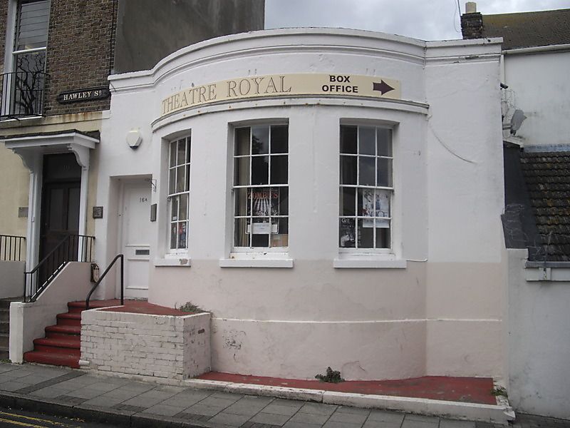
HAWLEY SQUARE
1.
1380
(North Side)
No 16A
TR 3570 NE 6/41
II GV
2.
Formerly shown as No 17.
Early C19. A single storey building with curved stucco front of 3 windows with
glazing bars intact. Included for group value.
Nos 4 to 6 (consec), former Holy Trinity Hall, former Methodist Chapel
and Nos 12 to 16A (consec) form a group
Listing NGR: TR3557170765
External links are from the relevant listing authority and, where applicable, Wikidata. Wikidata IDs may be related buildings as well as this specific building. If you want to add or update a link, you will need to do so by editing the Wikidata entry.


Other nearby listed buildings
