Approximate Location Map
Large Map »
Latitude: 53.4724 / 53°28'20"N
Longitude: -1.9666 / 1°57'59"W
OS Eastings: 402313
OS Northings: 397299
OS Grid: SK023972
Mapcode National: GBR GXQ8.1Y
Mapcode Global: WHB9L.RZQC
Plus Code: 9C5WF2CM+X9
Entry Name: Sunday school and boundary wall
Listing Date: 15 March 1984
Grade: II
Source: Historic England
Source ID: 1203897
English Heritage Legacy ID: 82168
ID on this website: 101203897
Location: Tintwistle, High Peak, Derbyshire, SK13
County: Derbyshire
District: High Peak
Civil Parish: Tintwistle
Built-Up Area: Tintwistle
Traditional County: Cheshire
Lieutenancy Area (Ceremonial County): Derbyshire
Church of England Parish: Tintwistle Christ Church
Church of England Diocese: Chester
Tagged with: Building School building
This list entry was subject to a Minor Amendment on 4 April 2023 to reformat the text to current standards
SK 09 NW
4/24
PARISH OF TINTWISTLE
CHURCH STREET (north side)
Sunday school and boundary wall
GV
II
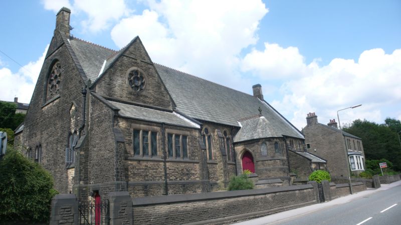
Sunday school. 1871. Coursed gritstone with gritstone dressings. Slate roof with crested ridge tiles, stone coped gables and stone gable end stacks. Rectangular plan with projecting south porch, a cross wing at the west end and various lean-to structures on north and south sides.
South elevation: raised above road level, central porch with polygonal front with four lancet windows. Flanking stairs on each side leading to doorways with pointed arches. Plank doors with elaborate iron hinges. Flanked by two-light pointed arched windows with geometrical tracery, three to the right and two to the left, divided by buttresses with two set-offs. A lean-to at each end, that to the right with lancet windows above and that to the left with a rose window in the gable of the cross wing. In the west and east gables a wheel window with trefoiled segments set within a pointed arched surround with horizontal sill. Wall to the road with chamfered coping stones and gate piers.
Listing NGR: SK0231397299
External links are from the relevant listing authority and, where applicable, Wikidata. Wikidata IDs may be related buildings as well as this specific building. If you want to add or update a link, you will need to do so by editing the Wikidata entry.


Other nearby listed buildings
