Latitude: 51.2861 / 51°17'10"N
Longitude: 0.3251 / 0°19'30"E
OS Eastings: 562234
OS Northings: 156678
OS Grid: TQ622566
Mapcode National: GBR Z5.W1F
Mapcode Global: VHHPN.LX6X
Plus Code: 9F3278PG+F2
Entry Name: Dales
Listing Date: 1 August 1952
Grade: II
Source: Historic England
Source ID: 1204378
English Heritage Legacy ID: 357315
ID on this website: 101204378
Location: Platt, Tonbridge and Malling, Kent, TN15
County: Kent
District: Tonbridge and Malling
Civil Parish: Platt
Built-Up Area: Borough Green
Traditional County: Kent
Lieutenancy Area (Ceremonial County): Kent
Church of England Parish: Platt St Mary the Virgin
Church of England Diocese: Rochester
Tagged with: Building
TQ 65 NW PLATT LONG MILL LANE 2/16 (west side)
1.8.52 Dales GV II
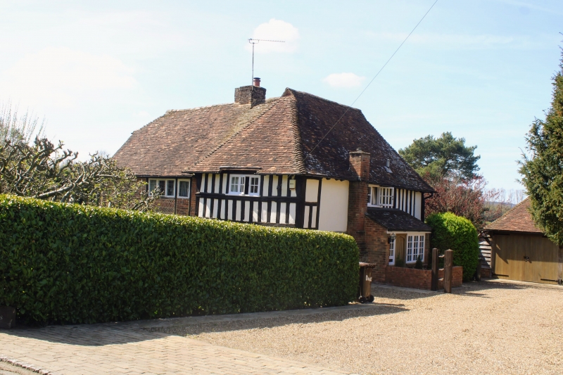
Farmhouse. C16, restored during C20. Random rubble stone ground floor, exposed timber-framing with red brick infilling, some herringbone infilling to left on first floor and exposed framing with plaster infilling under hippped return gable to right first floor jetty under gable, bressumer supported on joists and brackets, a secondary moulded bressumer forming the cill of the window on the first floor of the gable bay. Plain tiled roof, half-hipped to south, with central ridge stack. Two storeys; 2 windows on first floor, 2 windows and one C18 splayed bay under the jetty. All casements, except splayed bay which has glazing bar sashes. Modern weather porch on north side.
Listing NGR: TQ6223456677
External links are from the relevant listing authority and, where applicable, Wikidata. Wikidata IDs may be related buildings as well as this specific building. If you want to add or update a link, you will need to do so by editing the Wikidata entry.


Other nearby listed buildings