Latitude: 51.0273 / 51°1'38"N
Longitude: 0.5636 / 0°33'49"E
OS Eastings: 579873
OS Northings: 128448
OS Grid: TQ798284
Mapcode National: GBR PV5.K9J
Mapcode Global: FRA D62D.FF2
Plus Code: 9F322HG7+WF
Entry Name: Bell Farmhouse Bell House
Listing Date: 9 June 1952
Grade: II
Source: Historic England
Source ID: 1204753
English Heritage Legacy ID: 170310
ID on this website: 101204753
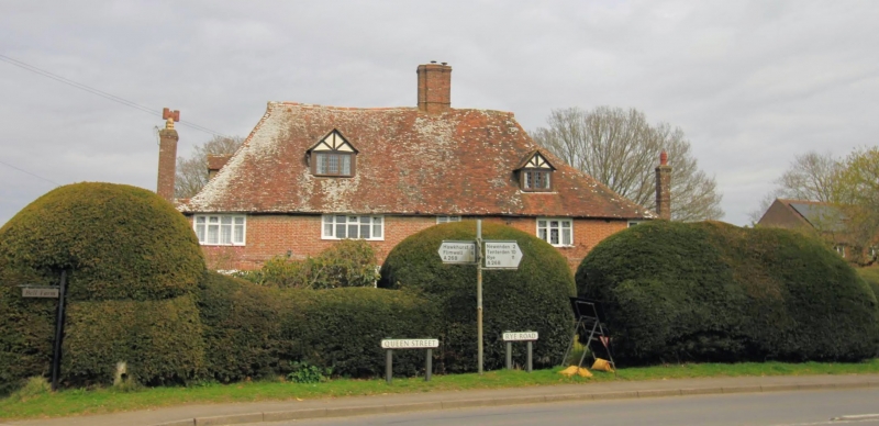
SANDHURST TQ7928 QUEEN STREET 1350-0/9/205 (North side) 09/06/52 Bell House and Bell Farmhouse GV II Sub-divided house at one time an Inn. Late Medieval open hall-house with inserted late C16 stack, refronted in brick in late C18 and refenestrated in C20. Timber-framed building, refaced in red brick with some grey headers. Stringcourse. Steeply pitched tiled roof with gablets and off central late C16 brick chimneystack and external stack to left hand side. 2 storeys and attics; 4 windows. 2 gabled dormers to front and 1 to left side elevation. Casement windows, the ground floor windows with cambered head linings. C20 door with strap-work motif. Plinth. Interior retains roll-moulded and embattled dais beam and parlour has late C16 roll-moulded ceiling and open fire-place with bread oven. Smoke blackened roof with octagonal crown post with 4 head braces to collar beam. Combed pargetting decoration.
Listing NGR: TQ7987328447
External links are from the relevant listing authority and, where applicable, Wikidata. Wikidata IDs may be related buildings as well as this specific building. If you want to add or update a link, you will need to do so by editing the Wikidata entry.


Other nearby listed buildings