Latitude: 50.5626 / 50°33'45"N
Longitude: -2.4466 / 2°26'47"W
OS Eastings: 368463
OS Northings: 73742
OS Grid: SY684737
Mapcode National: GBR PY.HRC0
Mapcode Global: FRA 57RL.4MX
Plus Code: 9C2VHH73+29
Entry Name: 3, with Boundary Wall
Listing Date: 17 May 1993
Grade: II
Source: Historic England
Source ID: 1205290
English Heritage Legacy ID: 381905
ID on this website: 101205290
Location: Chiswell, Dorset, DT5
County: Dorset
Civil Parish: Portland
Built-Up Area: Fortuneswell
Traditional County: Dorset
Lieutenancy Area (Ceremonial County): Dorset
Church of England Parish: Portland All Saints
Church of England Diocese: Salisbury
Tagged with: Building
PORTLAND
SY6873 CASTLE ROAD, Fortuneswell 969-1/3/88 (East side) No.3 3, with boundary wall.
GV II
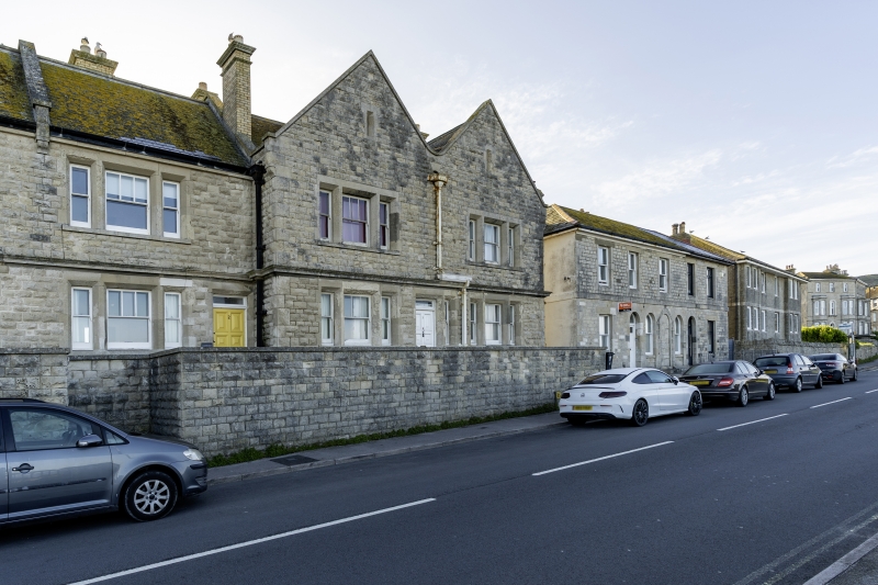
House at end of short terrace, formerly police housing, and attached to Police Station (qv). 1904. Rock-faced Portland stone, ashlar dressings, slate roofs. A twin-gabled unit in 2 storeys, each 1-windowed. Small ventilator in coped gable above tripartite sashes in flush chamfer surrounds. The central upper sash with two vertical bars. Central good panelled door under small plain transom light. Plinth, moulded mid string, continuous with Nos 1 and 2 (qv) adjoining; central cast-iron downpipe discharges to long hopper-head at mid-string level. Large square brick stacks just off ridge level. Subsidiary features: Across frontage a boundary wall in regular rock-faced stone to plain coping, continuous with boundary wall to Nos 1 and 2. Part of a significant composition, with no external change, and important on the skyline seen from the approach road from Victoria Square, below.
Listing NGR: SY6846373742
External links are from the relevant listing authority and, where applicable, Wikidata. Wikidata IDs may be related buildings as well as this specific building. If you want to add or update a link, you will need to do so by editing the Wikidata entry.


Other nearby listed buildings