Latitude: 52.8686 / 52°52'7"N
Longitude: -1.3422 / 1°20'31"W
OS Eastings: 444375
OS Northings: 330330
OS Grid: SK443303
Mapcode National: GBR 7H4.3H3
Mapcode Global: WHDH8.C525
Plus Code: 9C4WVM95+F4
Entry Name: The Lady in Grey
Listing Date: 10 November 1967
Grade: II
Source: Historic England
Source ID: 1205393
English Heritage Legacy ID: 83207
ID on this website: 101205393
Location: Great Wilne, South Derbyshire, DE72
County: Derbyshire
District: South Derbyshire
Civil Parish: Shardlow and Great Wilne
Traditional County: Derbyshire
Lieutenancy Area (Ceremonial County): Derbyshire
Church of England Parish: Shardlow and Great Wilne St James
Church of England Diocese: Derby
Tagged with: Architectural structure
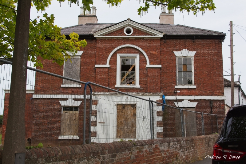
SK 44 30 PARISH OF SHARDLOW AND GREAT WILNE WILNE LANE 7/221 (West Side) 10.11.67 The Lady in Grey GV II House, now partly a restaurant. Late C18 with C20 additions. Red brick with painted stone dressings and plain stone first floor band. Hipped slate roof with rendered rear wall stacks and moulded eaves cornice. Two storeys and three bays with advanced pedimented central bay which has a two storey blind semi-circular headed recess with stone impost band and moulded arch. To ground floor the centre bay is covered by a C20 flat roofed rendered addition with brick quoins and glazing bar sash to front, over which is a Sun Alliance fire insurance plaque. Behind the addition is the original semi-circular headed doorcase with rusticated jambs, C20 glazed door and traceried iron fanlight below open pediment on moulded consoles. To either side there are glazing bar sashes below rusticated wedge lintels with double keystones and above there are two similar to either side of central glazing bar sashes in moulded surround. Above again to centre is a shallow moulded pediment with small moulded circular window. Attached to north side is the original stable block, now part of the restaurant, which is rendered and has a hipped C20 concrete tile roof and an assortment of C20 windows. This part is of no special interest.
Listing NGR: SK4437530329
External links are from the relevant listing authority and, where applicable, Wikidata. Wikidata IDs may be related buildings as well as this specific building. If you want to add or update a link, you will need to do so by editing the Wikidata entry.


Other nearby listed buildings