Latitude: 55.0378 / 55°2'16"N
Longitude: -2.9582 / 2°57'29"W
OS Eastings: 338862
OS Northings: 571898
OS Grid: NY388718
Mapcode National: GBR 7BS5.CW
Mapcode Global: WH7Z9.JMKS
Plus Code: 9C7V22QR+4P
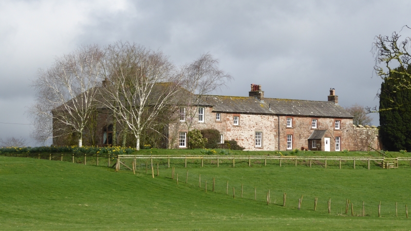
Entry Name: Farmhouse and Barn Adjoining Wall to West of Kirkandrews Tower
Listing Date: 15 June 1984
Grade: II
Source: Historic England
Source ID: 1205417
English Heritage Legacy ID: 78156
ID on this website: 101205417
Location: Cumberland, Cumbria, CA6
County: Cumberland
District: Carlisle
Civil Parish: Kirkandrews
Traditional County: Cumberland
Lieutenancy Area (Ceremonial County): Cumbria
Church of England Parish: Kirkandrews-on-Esk St Andrew
Church of England Diocese: Carlisle
Tagged with: Farmhouse
NY 37 SE KIRKANDREWS KIRXANDUMS ON ESK
14/73 Farmhouse and barn, adjoining wall to west of Kirkandrews Tower
G.V. II
Farmhouse and barn. Probably 1827 for the Graham family. Red sandstone rubble and river cobbles, graduated green slate roof, cream brick chimney stacks. 2-storey, 4-bay house; 2-bay barn in L-shape. Farmhouse has 2 plank doors in plain stone surrounds with glazed fanlights. Sash windows with glazing bars in plain stone surrounds. Barn to right has large plank doors, casement window with glazing bars above; smaller entrance with plank door to left. Listed partly for G.V. with Kirkandrews Tower.
Listing NGR: NY3886271898
External links are from the relevant listing authority and, where applicable, Wikidata. Wikidata IDs may be related buildings as well as this specific building. If you want to add or update a link, you will need to do so by editing the Wikidata entry.


Other nearby listed buildings