Latitude: 51.7163 / 51°42'58"N
Longitude: -1.9681 / 1°58'5"W
OS Eastings: 402297
OS Northings: 201953
OS Grid: SP022019
Mapcode National: GBR 3QY.77G
Mapcode Global: VHB2Q.T4W3
Plus Code: 9C3WP28J+GP
Entry Name: 12 and 12A, Cricklade Street
Listing Date: 14 June 1948
Last Amended: 24 May 1993
Grade: II
Source: Historic England
Source ID: 1205678
English Heritage Legacy ID: 365240
ID on this website: 101205678
Location: Cirencester, Cotswold, Gloucestershire, GL7
County: Gloucestershire
District: Cotswold
Civil Parish: Cirencester
Built-Up Area: Cirencester
Traditional County: Gloucestershire
Lieutenancy Area (Ceremonial County): Gloucestershire
Church of England Parish: Cirencester St John the Baptist
Church of England Diocese: Gloucester
Tagged with: Building
CIRENCESTER
SP0201 CRICKLADE STREET 578-1/6/99 (South West side) 14/06/48 Nos.12 AND 12A (Formerly Listed as: CRICKLADE STREET No.12)
GV II
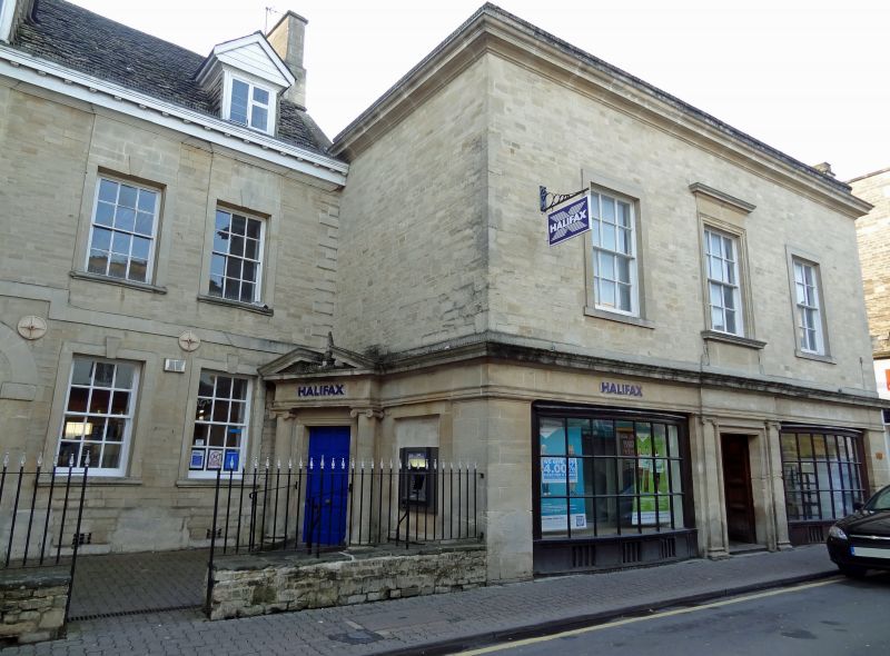
Building Society office with flat over. Early/mid C18 with mid C19 wing to rear and later alterations. Coursed squared limestone with ashlar dressings; stone slate roof with coped verge to right; rebuilt ashlar right-end stack. Wing to rear is coursed squared limestone rubble, Welsh slate roof, rebuilt brick lateral stack on gablet to left side. Main range set back from Cricklade Street with wing to rear. 2 storeys and attic; 3-window range. First floor has three 6/6-pane late C18 sashes in flat beaded surrounds with moulded stone cills, keyed lintels and ashlar panels continued upwards to cornice; ground floor has 2 similar windows in similar surrounds without panels above. Door to left has 6 raised-and-fielded panels, single pane overlight, in beaded reveal with keyed lintel set within broad segmental-headed arch with impost blocks and keystone flush with wall, possibly former carriage entrance. 2 gabled dormers with C20 two-light leaded casements. Deep chamfered plinth; band course over ground floor steps down to right; rusticated quoins to first floor left and right; moulded timber eaves cornice, lower mouldings breaking forward over panels above first floor windows. Entrance now via C19/C20 Doric porch with broken pediment across corner to right. C19 wing to rear is 2 storeys and attic, 2-window range with 6/6-pane sashes in plain reveals with flat arch lintels. INTERIOR partially inspected; ground floor opened out and with C20 alterations.
Listing NGR: SP0229701953
External links are from the relevant listing authority and, where applicable, Wikidata. Wikidata IDs may be related buildings as well as this specific building. If you want to add or update a link, you will need to do so by editing the Wikidata entry.


Other nearby listed buildings