Latitude: 53.4077 / 53°24'27"N
Longitude: -2.9897 / 2°59'23"W
OS Eastings: 334301
OS Northings: 390556
OS Grid: SJ343905
Mapcode National: GBR 73N.8F
Mapcode Global: WH877.1LLY
Plus Code: 9C5VC256+34
Entry Name: Rigby's Buildings
Listing Date: 14 March 1975
Last Amended: 19 June 1985
Grade: II
Source: Historic England
Source ID: 1206420
English Heritage Legacy ID: 213986
ID on this website: 101206420
Location: Liverpool, Merseyside, L2
County: Liverpool
Electoral Ward/Division: Central
Parish: Non Civil Parish
Built-Up Area: Liverpool
Traditional County: Lancashire
Lieutenancy Area (Ceremonial County): Merseyside
Church of England Parish: Liverpool Our Lady and St Nicholas
Church of England Diocese: Liverpool
Tagged with: Pub
SJ 3490 NW DALE STREET (north side) L2
48/351 Nos. 21-25 (odd) (Rigby's Buildings) (formerly listed as Rigby's 14.3.75 Buildings including Palatine Public House)
G.V. II
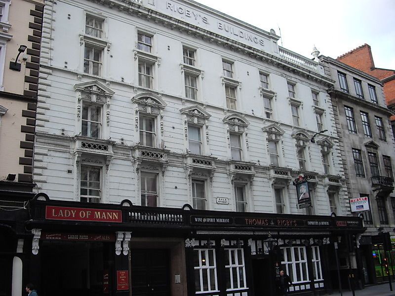
Office and public house. Dated 1726 on facade, but rebuilt c.1850. Stucco. 5 storeys, 7 bays. Ground floor has later C19 front with large leaded windows and continuous fascia. 1st floor windows, most to 2nd floor and all above it are 4- pane sashes. 1st floor windows have balustrades, ornamented architraves and lintels. 2nd floor is the richest, with small balconies, architraves and consoled pediments. Top modillioned cornice, balustraded parapet with urns and acroteria and carved "Rigby's Buildings".
Listing NGR: SJ3430190556
External links are from the relevant listing authority and, where applicable, Wikidata. Wikidata IDs may be related buildings as well as this specific building. If you want to add or update a link, you will need to do so by editing the Wikidata entry.


Other nearby listed buildings