Approximate Location Map
Large Map »
Latitude: 52.6404 / 52°38'25"N
Longitude: -2.4909 / 2°29'27"W
OS Eastings: 366879
OS Northings: 304850
OS Grid: SJ668048
Mapcode National: GBR BW.6MH4
Mapcode Global: WH9D8.QW2P
Plus Code: 9C4VJGR5+5J
Entry Name: 7
Listing Date: 9 August 1974
Grade: II
Source: Historic England
Source ID: 1206609
English Heritage Legacy ID: 362002
ID on this website: 101206609
Location: Coalbrookdale, Telford and Wrekin, Shropshire, TF8
County: Telford and Wrekin
Civil Parish: The Gorge
Built-Up Area: Telford
Traditional County: Shropshire
Lieutenancy Area (Ceremonial County): Shropshire
Church of England Parish: Coalbrookdale
Church of England Diocese: Hereford
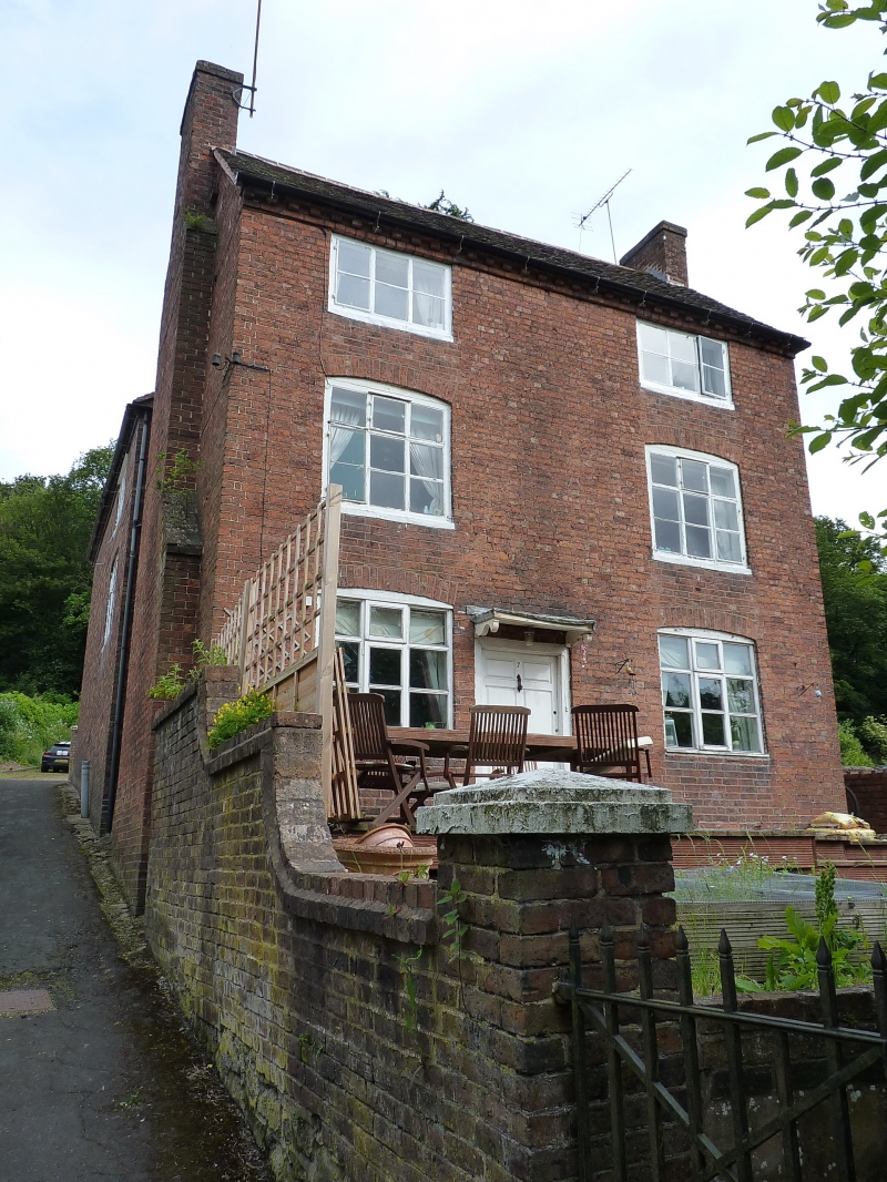
COALBROOKDALE WOODSIDE
1.
5362 No 7
SJ 6604 9/138 9.8.74
II GV
2.
Early C19, the core probably C18. Red brick; 3 storeys; 2 casement windows with
cambered heads and cast-iron glazing bars; plain C18 wooden doorcase with cornice
hood on brackets and 6-panelled door; modillion eaves; tiled roof.
Listing NGR: SJ6687904850
External links are from the relevant listing authority and, where applicable, Wikidata. Wikidata IDs may be related buildings as well as this specific building. If you want to add or update a link, you will need to do so by editing the Wikidata entry.


Other nearby listed buildings
