Latitude: 51.2129 / 51°12'46"N
Longitude: -3.4744 / 3°28'27"W
OS Eastings: 297113
OS Northings: 146997
OS Grid: SS971469
Mapcode National: GBR LJ.3X6X
Mapcode Global: VH5JY.QSL2
Plus Code: 9C3R6G7G+57
Entry Name: 45 and 47, Quay Street
Listing Date: 4 July 1952
Grade: II
Source: Historic England
Source ID: 1206994
English Heritage Legacy ID: 391214
ID on this website: 101206994
Location: Higher Town, Somerset, TA24
County: Somerset
District: Somerset West and Taunton
Civil Parish: Minehead
Built-Up Area: Minehead
Traditional County: Somerset
Lieutenancy Area (Ceremonial County): Somerset
Tagged with: Building
MINEHEAD
SS9746 QUAY STREET 900-1/3/63 (West side) 04/07/52 Nos.45 AND 47
GV II
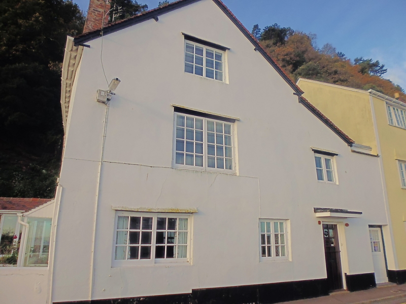
House, now 2 dwellings, at a right angle to the road. Early C18. Painted render over rubblestone, plain tile roof with exposed rafter-ends and two C20 dormers to front (south) slope, internal lateral stack to front right with brick stack above the eaves. 2-unit plan with rear outshut, a lower set-back wing to the left and a 2-storey wall to rear right with a door connected to No.49 (qv). 2 storeys with attic; 3-window range to the front (south). 3 storeys; 2-window range to street front (east). The south front (No.45) has C20 door, porch and mostly 3-light casement windows, the east gable end (No.47) has a C19 two-light casement window to each floor; to the right, in the outshut, is a C20 door and hood with a small 2-light casement window above and to the left. INTERIOR not inspected.
Listing NGR: SS9711346997
External links are from the relevant listing authority and, where applicable, Wikidata. Wikidata IDs may be related buildings as well as this specific building. If you want to add or update a link, you will need to do so by editing the Wikidata entry.


Other nearby listed buildings