Latitude: 54.9049 / 54°54'17"N
Longitude: -1.3781 / 1°22'41"W
OS Eastings: 439973
OS Northings: 556859
OS Grid: NZ399568
Mapcode National: GBR VD8.6Y
Mapcode Global: WHD55.SZY7
Plus Code: 9C6WWJ3C+WQ
Entry Name: 14, Foyle Street
Listing Date: 10 November 1978
Grade: II
Source: Historic England
Source ID: 1207081
English Heritage Legacy ID: 391456
ID on this website: 101207081
Location: Sunderland, Tyne and Wear, SR1
County: Sunderland
Electoral Ward/Division: Hendon
Parish: Non Civil Parish
Built-Up Area: Sunderland
Traditional County: Durham
Lieutenancy Area (Ceremonial County): Tyne and Wear
Church of England Parish: Hendon
Church of England Diocese: Durham
Tagged with: Building
SUNDERLAND
NZ3956NE FOYLE STREET 920-1/20/79 (West side) 10/11/78 No.14
GV II
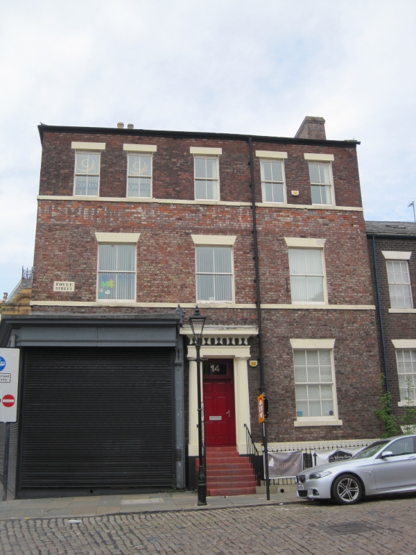
House. c1840 with extra storey added c1900. Garden wall bond brick (5 and one) with painted basement and painted ashlar dressings; Welsh slate roof. 2 storeys and basement, 3 windows. Ground floor obscured at left by C20 shop front. Elevation to Foyle Street has steps up to central 6-panelled door, the centre panels round, which folds back to form reveals of doorcase of fluted Greek Doric pilasters with palmette and anthemion frieze in entablature. Wedge stone lintels to sash with glazing bars to right of door with projecting stone sill and to first-floor 4-pane sashes on sill band. Second-floor 4-pane sashes on sill band have flat stone lintels. Hipped roof has 2 sashes with glazing bars in dormers with boarded gables and slate-hung sides. End and rear chimneys. Left return partly obscured by one-storey shop on Borough Road.
Listing NGR: NZ3997356858
External links are from the relevant listing authority and, where applicable, Wikidata. Wikidata IDs may be related buildings as well as this specific building. If you want to add or update a link, you will need to do so by editing the Wikidata entry.


Other nearby listed buildings