Latitude: 54.908 / 54°54'28"N
Longitude: -1.3764 / 1°22'34"W
OS Eastings: 440083
OS Northings: 557210
OS Grid: NZ400572
Mapcode National: GBR VDJ.2N
Mapcode Global: WHD55.TWST
Plus Code: 9C6WWJ5F+6F
Entry Name: 170, 171 and 173, High Street West
Listing Date: 10 November 1978
Grade: II
Source: Historic England
Source ID: 1207092
English Heritage Legacy ID: 391486
ID on this website: 101207092
Location: Sunderland, Tyne and Wear, SR1
County: Sunderland
Electoral Ward/Division: Hendon
Parish: Non Civil Parish
Built-Up Area: Sunderland
Traditional County: Durham
Lieutenancy Area (Ceremonial County): Tyne and Wear
Church of England Parish: Hendon
Church of England Diocese: Durham
Tagged with: Building
SUNDERLAND
NZ4057 HIGH STREET WEST 920-1/12/107 (South side) 10/11/78 Nos.170, 171 AND 173
GV II
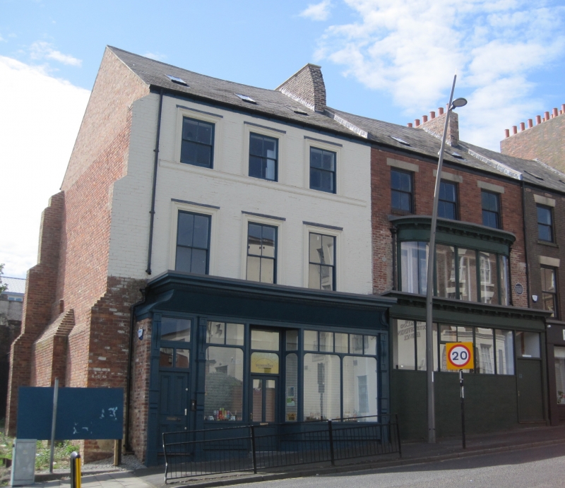
Two houses with later shops. Late C18 houses; late C19 shops. No.173 at right refronted in late C19 and top storey rebuilt c1980. No.172 is subsumed in No.173. Nos 170 & 171 at left painted brick with painted ashlar dressings; No.173 bright brick with ashlar dressings and cast-iron first floor shop window. Welsh slate roofs. Each 3 storeys, 3 windows. Left building has projecting ground floor shop front, boarded below cornice; 4-pane sashes in architraves on upper floors, those on top floor smaller and with sill string. Right building has boarded ground floor shop; first floor projecting showroom window with wide central and curved corner sheets of glass set in slender cast-iron pilasters below cornice and entablature with brackets and mullions. Renewed second-floor windows have wedge stone lintels and projecting stone sills.
Listing NGR: NZ4008357210
External links are from the relevant listing authority and, where applicable, Wikidata. Wikidata IDs may be related buildings as well as this specific building. If you want to add or update a link, you will need to do so by editing the Wikidata entry.


Other nearby listed buildings