Approximate Location Map
Large Map »
Latitude: 52.6289 / 52°37'44"N
Longitude: -2.4832 / 2°28'59"W
OS Eastings: 367392
OS Northings: 303571
OS Grid: SJ673035
Mapcode National: GBR BW.7HCC
Mapcode Global: WH9DG.T5QY
Plus Code: 9C4VJGH8+HP
Entry Name: 7, Belle Vue Road
Listing Date: 8 April 1983
Grade: II
Source: Historic England
Source ID: 1207372
English Heritage Legacy ID: 362130
ID on this website: 101207372
Location: Ironbridge, Telford and Wrekin, Shropshire, TF8
County: Telford and Wrekin
Civil Parish: The Gorge
Built-Up Area: Telford
Traditional County: Shropshire
Lieutenancy Area (Ceremonial County): Shropshire
Church of England Parish: Ironbridge
Church of England Diocese: Hereford
Tagged with: Building
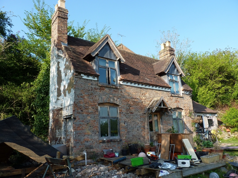
IRONBRIDGE BELLE VUE ROAD
1.
5362 No 7
SJ 6703 NW 15/265
II GV
2.
C18 plastered brick cottage. Plain tile roof with gabled end and brick dentil eaves
course. One storey and attic. Two modern casement windows and 2 modern flat roof
dormers. Central glazed door with hood on brackets. Brick end stacks, right-hand
is large external stack with off-sets.
Listing NGR: SJ6739203571
External links are from the relevant listing authority and, where applicable, Wikidata. Wikidata IDs may be related buildings as well as this specific building. If you want to add or update a link, you will need to do so by editing the Wikidata entry.


Other nearby listed buildings
