Latitude: 52.4135 / 52°24'48"N
Longitude: 0.7453 / 0°44'43"E
OS Eastings: 586807
OS Northings: 283040
OS Grid: TL868830
Mapcode National: GBR RD7.P85
Mapcode Global: VHKCC.VLVQ
Plus Code: 9F42CP7W+94
Entry Name: Losinga
Listing Date: 10 March 1971
Grade: II
Source: Historic England
Source ID: 1207476
English Heritage Legacy ID: 384678
ID on this website: 101207476
Location: Thetford, Breckland, Norfolk, IP24
County: Norfolk
District: Breckland
Civil Parish: Thetford
Built-Up Area: Thetford
Traditional County: Suffolk
Lieutenancy Area (Ceremonial County): Norfolk
Church of England Parish: Thetford St Cuthbert
Church of England Diocese: Norwich
Tagged with: Building
THETFORD
TL8683 BRIDGE STREET 617-1/5/13 (North West side) 10/03/71 No.22 Losinga
GV II
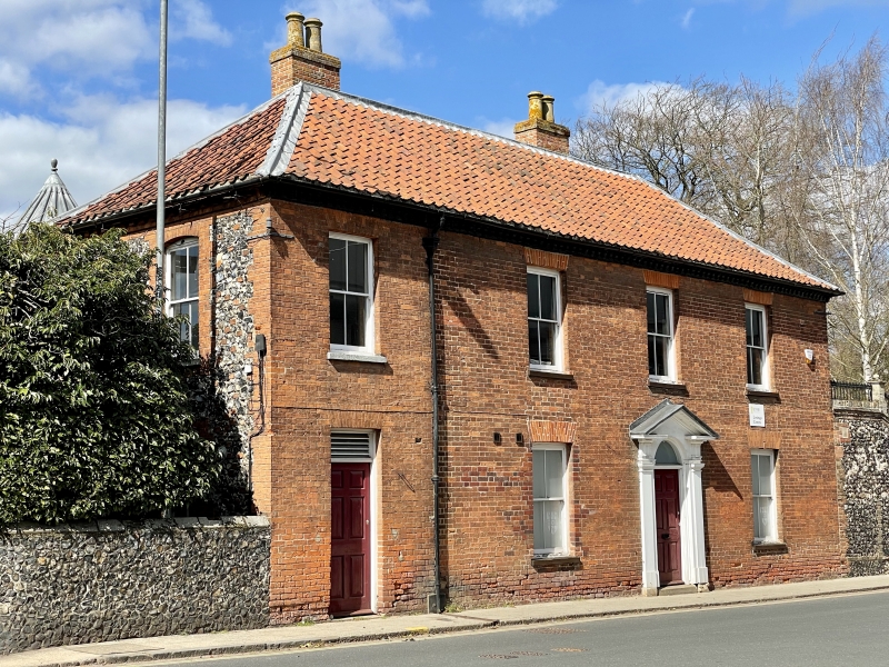
Shown as No.14 on OS map. House. Early C19. Flint with brick dressings. Red brick facade added mid C19 and house extended one bay south-west in later C19. 2 storeys, originally in 3 bays, now 3 plus one bay. Central 6-panelled door to 3-bay portion under a plain fanlight set within a plain doorcase with block entablatures supporting an open pediment. Soffits of pediment with Greek key decoration. One sash window right and left with 2/2 glazing bars and gauged skewback arches. 3 similar first-floor sashes. Added south bay with 6-panelled door, overlight and gauged skewback arch. One 2/2 sash above. Modillion eaves cornice and hipped roof. Stack on north-east slope and on rear wing. INTERIOR: stick baluster staircase with ramped and wreathed handrail.
Listing NGR: TL8680783040
External links are from the relevant listing authority and, where applicable, Wikidata. Wikidata IDs may be related buildings as well as this specific building. If you want to add or update a link, you will need to do so by editing the Wikidata entry.


Other nearby listed buildings