Approximate Location Map
Large Map »
Latitude: 52.629 / 52°37'44"N
Longitude: -2.4886 / 2°29'18"W
OS Eastings: 367027
OS Northings: 303585
OS Grid: SJ670035
Mapcode National: GBR BW.7G1G
Mapcode Global: WH9DG.R55V
Plus Code: 9C4VJGH6+JH
Entry Name: 2-6, New Road
Listing Date: 9 August 1974
Grade: II
Source: Historic England
Source ID: 1207785
English Heritage Legacy ID: 362199
ID on this website: 101207785
Location: Ironbridge, Telford and Wrekin, Shropshire, TF8
County: Telford and Wrekin
Civil Parish: The Gorge
Built-Up Area: Telford
Traditional County: Shropshire
Lieutenancy Area (Ceremonial County): Shropshire
Church of England Parish: Ironbridge
Church of England Diocese: Hereford
Tagged with: Building
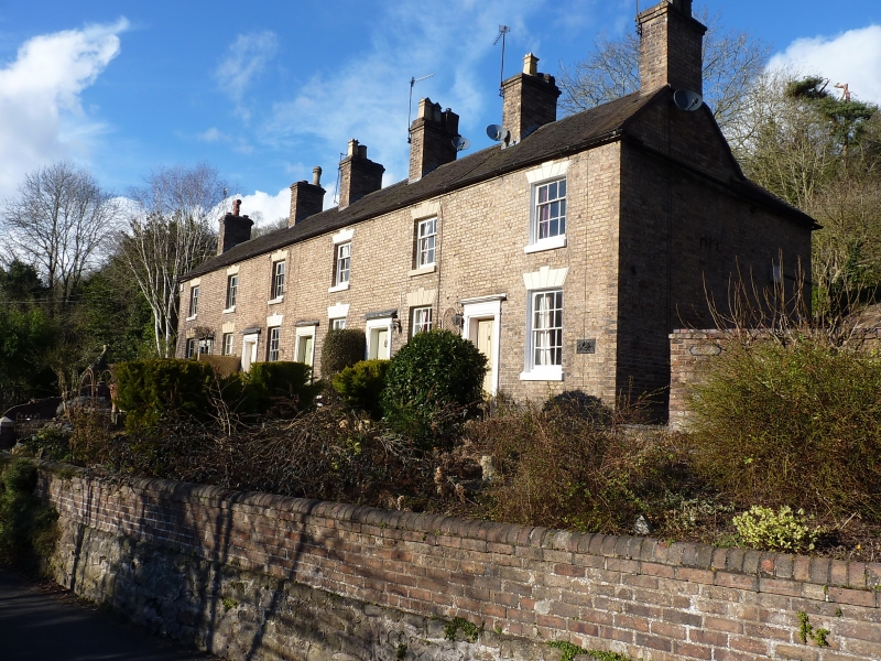
IRONBRIDGE NEW ROAD
1.
5362 Nos 2 to 6 (consecutive)
SJ 6703 NW 15/342 9.8.74
II GV
2.
Early C19 terraced range of brick cottages, with old tile roof. Two storeys. Each
has one sash window with channelled lintel and a wood pilaster doorcase with 4-flush-
panelled door.
Listing NGR: SJ6702703585
External links are from the relevant listing authority and, where applicable, Wikidata. Wikidata IDs may be related buildings as well as this specific building. If you want to add or update a link, you will need to do so by editing the Wikidata entry.


Other nearby listed buildings
