Latitude: 50.515 / 50°30'54"N
Longitude: -3.7546 / 3°45'16"W
OS Eastings: 275694
OS Northings: 69827
OS Grid: SX756698
Mapcode National: GBR QJ.1TCG
Mapcode Global: FRA 370P.R36
Plus Code: 9C2RG68W+24
Entry Name: Gate Piers and Boundary Wall in Front of Chapel of St Lawrence
Listing Date: 10 May 1973
Last Amended: 1 September 1992
Grade: II*
Source: Historic England
Source ID: 1207825
English Heritage Legacy ID: 376147
ID on this website: 101207825
Location: Ashburton, Teignbridge, Devon, TQ13
County: Devon
District: Teignbridge
Civil Parish: Ashburton
Built-Up Area: Ashburton
Traditional County: Devon
Lieutenancy Area (Ceremonial County): Devon
Church of England Parish: Ashburton St Andrew
Church of England Diocese: Exeter
Tagged with: Gatepost
ASHBURTON
SX7569 ST LAWRENCE LANE 849-1/10/169 (East side) 10/05/73 Gate piers and boundary wall in front of Chapel of St Lawrence (Formerly Listed as: ST LAWRENCE LANE (East side) Entrance gates and wall of playground at Old Grammar School)
GV II*
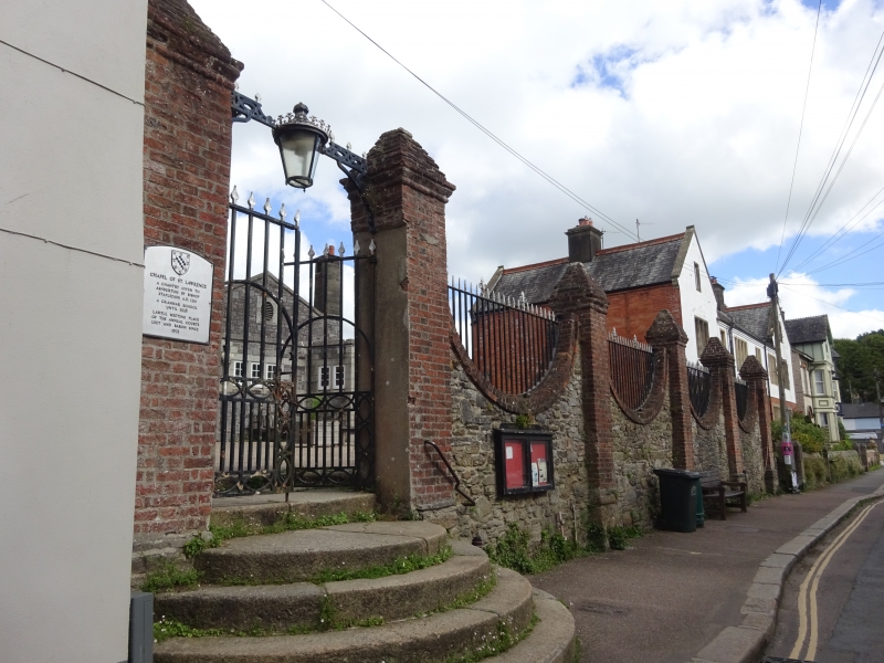
Gate piers and boundary wall in front of Chapel of St Lawrence. Probably mid C18. Stone rubble with red-brick piers and copings. 5-bay design with sixth bay in return to right. Square piers with moulded pyramidal caps between and flanking the bays. Walls within the bays have curved copings in the manner of festoons. Gate piers to left slightly taller than the rest. Gates and railings on the walls appear to be C19 and C20; overthrow lamp looks C19. Flight of semi-circular granite steps up from street.
Listing NGR: SX7569469827
External links are from the relevant listing authority and, where applicable, Wikidata. Wikidata IDs may be related buildings as well as this specific building. If you want to add or update a link, you will need to do so by editing the Wikidata entry.


Other nearby listed buildings