Approximate Location Map
Large Map »
Latitude: 52.5815 / 52°34'53"N
Longitude: -2.1282 / 2°7'41"W
OS Eastings: 391407
OS Northings: 298192
OS Grid: SO914981
Mapcode National: GBR 1DM.80
Mapcode Global: WHBFZ.8CTT
Plus Code: 9C4VHVJC+HP
Entry Name: Pier to North Side of Churchyard to West of Entrance
Listing Date: 31 March 1992
Grade: II
Source: Historic England
Source ID: 1207942
English Heritage Legacy ID: 378558
ID on this website: 101207942
Location: Wolverhampton, West Midlands, WV2
County: City of Wolverhampton
Electoral Ward/Division: St Peter's
Parish: Non Civil Parish
Built-Up Area: Wolverhampton
Traditional County: Staffordshire
Lieutenancy Area (Ceremonial County): West Midlands
Church of England Parish: Central Wolverhampton
Church of England Diocese: Lichfield
Tagged with: Architectural structure
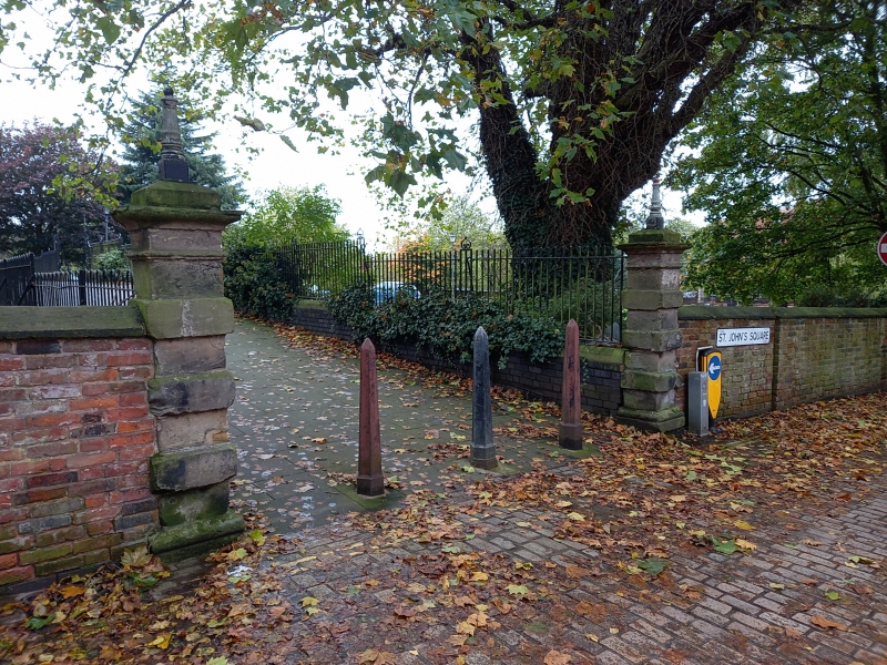
WOLVERHAMPTON
SO9198SW ST JOHN'S SQUARE
895-1/13/318 (North side)
Pier to N Side of Churchyard to W of
Entrance
GV II
Pier. 1758-76. Ashlar. Banded pier with entablature and iron
lantern.
Listing NGR: SO9140798192
External links are from the relevant listing authority and, where applicable, Wikidata. Wikidata IDs may be related buildings as well as this specific building. If you want to add or update a link, you will need to do so by editing the Wikidata entry.


Other nearby listed buildings
