Approximate Location Map
Large Map »
Latitude: 52.2011 / 52°12'3"N
Longitude: -3.0269 / 3°1'36"W
OS Eastings: 329911
OS Northings: 256366
OS Grid: SO299563
Mapcode National: GBR F5.3FSL
Mapcode Global: VH778.HY41
Plus Code: 9C4R6X2F+C6
Entry Name: Toll House
Listing Date: 26 July 1976
Grade: II
Source: Historic England
Source ID: 1208007
English Heritage Legacy ID: 385792
ID on this website: 101208007
Location: Kington, County of Herefordshire, HR5
County: County of Herefordshire
Civil Parish: Kington
Built-Up Area: Kington
Traditional County: Herefordshire
Lieutenancy Area (Ceremonial County): Herefordshire
Church of England Parish: Kington
Church of England Diocese: Hereford
KINGTON
SO2956
643-1/1/31
26/07/76
BRIDGE STREET
(West side)
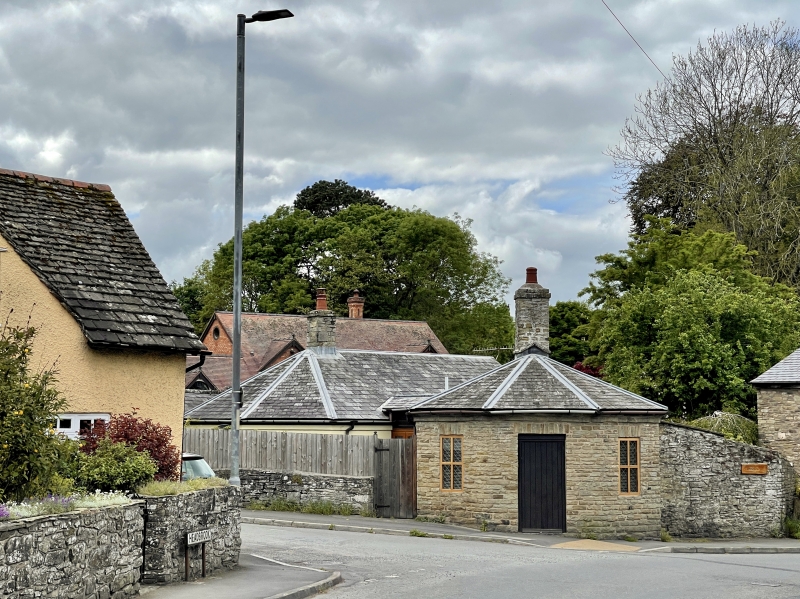
Toll House
GV
II
Toll house. Early C19, restored late C20. Coursed stone; Welsh
slate faceted roof; central rubble stack. Octagonal plan.
Single storey; C20 cross windows with leaded lights and some
casements; C20 plank door; stone flat arches; stone band to
eaves.
Listing NGR: SO2991156366
External links are from the relevant listing authority and, where applicable, Wikidata. Wikidata IDs may be related buildings as well as this specific building. If you want to add or update a link, you will need to do so by editing the Wikidata entry.


Other nearby listed buildings
