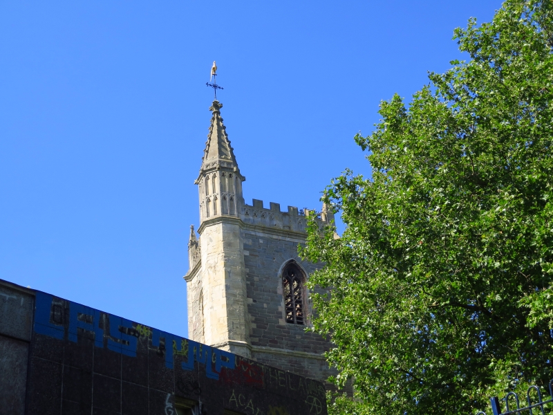
Latitude: 51.4546 / 51°27'16"N
Longitude: -2.5917 / 2°35'30"W
OS Eastings: 358980
OS Northings: 173017
OS Grid: ST589730
Mapcode National: GBR C8K.SD
Mapcode Global: VH88N.1P6R
Plus Code: 9C3VFC35+V8
Entry Name: Tower of Church of St Mary Le Port
Listing Date: 8 January 1959
Grade: II
Source: Historic England
Source ID: 1208338
English Heritage Legacy ID: 379770
ID on this website: 101208338
Location: Bristol, BS1
County: City of Bristol
Electoral Ward/Division: Central
Parish: Non Civil Parish
Built-Up Area: Bristol
Traditional County: Gloucestershire
Lieutenancy Area (Ceremonial County): Bristol
Church of England Parish: Bristol St Stephen with St James and St John the Baptist with St Michael and St George
Church of England Diocese: Bristol
Tagged with: Tower
BRISTOL
ST5873SE HIGH STREET, Centre 901-1/11/590 (East side) 08/01/59 Tower of Church of St Mary-le-Port
II
Church tower. C15. Limestone ashlar with coursed Pennant rubble. Perpendicular Gothic with a Somerset-type tower. 3 stages divided by drip moulds, with angle buttresses and an octagonal SE stair tower. W door with hollow-moulded reveals and foliate stops; 4-light window above, and a blind, 2-light window in the second stage. Belfry with 2-light louvred windows, a crenellated parapet of blind tracery panels with crocketed corner pinnacles and a SE spirelet with tracery panels, crockets and a carved finial. INTERIOR not inspected. The unclerestoreyed nave had one aisle and 4-centred arches with moulded capitals. It was destroyed by bombing in the Second World War. (Gomme A, Jenner M and Little B: Bristol, An Architectural History: Bristol: 1979-: 60).
Listing NGR: ST5898073017
External links are from the relevant listing authority and, where applicable, Wikidata. Wikidata IDs may be related buildings as well as this specific building. If you want to add or update a link, you will need to do so by editing the Wikidata entry.


Other nearby listed buildings