Latitude: 52.6331 / 52°37'59"N
Longitude: -1.6966 / 1°41'47"W
OS Eastings: 420633
OS Northings: 303966
OS Grid: SK206039
Mapcode National: GBR 4FD.XKJ
Mapcode Global: WHCH3.X29R
Plus Code: 9C4WJ8M3+69
Entry Name: 34, Market Street
Listing Date: 28 February 1992
Grade: II
Source: Historic England
Source ID: 1208677
English Heritage Legacy ID: 386557
ID on this website: 101208677
Location: Tamworth, Staffordshire, B79
County: Staffordshire
District: Tamworth
Electoral Ward/Division: Castle
Parish: Non Civil Parish
Built-Up Area: Tamworth
Traditional County: Warwickshire
Lieutenancy Area (Ceremonial County): Staffordshire
Church of England Parish: Tamworth St Editha
Church of England Diocese: Lichfield
Tagged with: Building
TAMWORTH
SK2003NE MARKET STREET 670-1/9/126 (South side) No.34
GV II
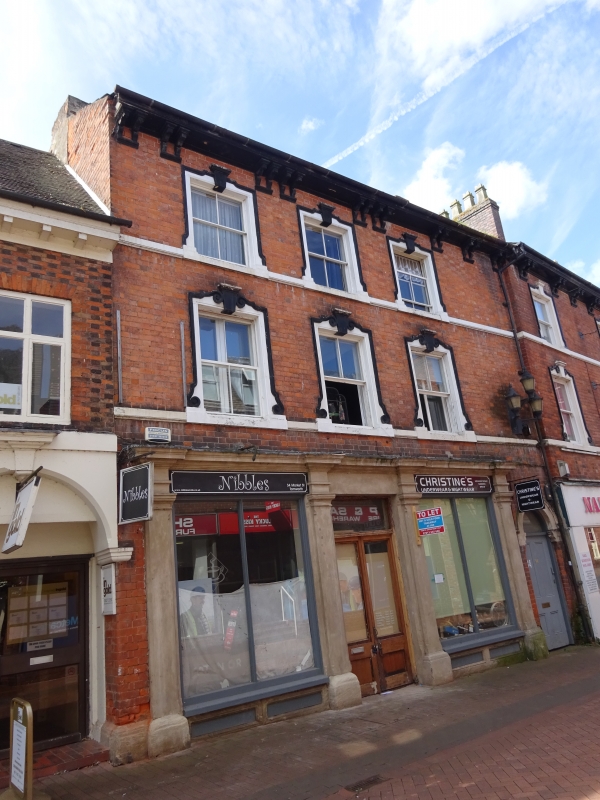
House, now 2 shops and flats above. Early C18 with c1850 front range. Brick with ashlar dressings; 2-span roof with slate to front span, tile to rear with brick cross-axial stack. Double-depth plan. 3 storeys; 3-window range. 1st and 2nd floor sill bands and bracketed eaves. Shop front with stop-chamfered pilasters and entablature, central entrance with overlight to paired glazed doors; round-headed entrance to right end has archivolt and keystone with rosette over fanlight and 4-panel door. 1st and 2nd floors have windows with keystones to shouldered architraves, those to 1st floor with scrolls, and 4-pane sashes; projecting C19 iron lamps. Rear has C18 range with chequered brick and segmental-headed windows, casements with pegged frames, 2 dormer windows. Interior not inspected.
Listing NGR: SK2063303966
External links are from the relevant listing authority and, where applicable, Wikidata. Wikidata IDs may be related buildings as well as this specific building. If you want to add or update a link, you will need to do so by editing the Wikidata entry.


Other nearby listed buildings