Latitude: 54.9031 / 54°54'11"N
Longitude: -1.3799 / 1°22'47"W
OS Eastings: 439860
OS Northings: 556663
OS Grid: NZ398566
Mapcode National: GBR VCZ.MG
Mapcode Global: WHD5C.S121
Plus Code: 9C6WWJ3C+62
Entry Name: Drinking Fountain at North End of Central Avenue NZ 3986 5666
Listing Date: 10 November 1978
Last Amended: 17 October 1994
Grade: II
Source: Historic England
Source ID: 1208918
English Heritage Legacy ID: 391523
ID on this website: 101208918
Location: Mowbray Gardens, Sunderland, Tyne and Wear, SR2
County: Sunderland
Electoral Ward/Division: Hendon
Parish: Non Civil Parish
Built-Up Area: Sunderland
Traditional County: Durham
Lieutenancy Area (Ceremonial County): Tyne and Wear
Church of England Parish: Hendon
Church of England Diocese: Durham
Tagged with: Drinking fountain
SUNDERLAND
NZ3956NE MOWBRAY EXTENSION PARK 920-1/20/146 (North side) 10/11/78 Drinking fountain at north end of Central Avenue NZ 3986 5666 (Formerly Listed as: MOWBRAY EXTENSION PARK Drinking fountain at north end of Central Avenue)
GV II
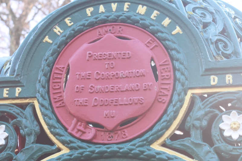
Drinking fountain in north extension of Mowbray Park . Dated 1878. Founder's plate Glenfield & Kennedy Ltd., Kilmarnock; for the Order of Oddfellows in memory of William Hall; gift to the Corporation of Sunderland. Cast-iron. Small domed canopy with elaborate foliage and 4 cusped arches on columns shelters bollard-shaped drinking fountain. Above each arch an escutcheon and motto. On N and S: KEEP THE PAVEMENT DRY, and NIL DESPERANDUM AUSPICE DEO 1878, (the borough's motto) with symbols of borough and of Oddfellows. On E and W: AMICITIA AMOR ET VERITAS 1878 with on E, IN MEMORY OF WM HALL PPGM OF THE SUNDERLAND DISTRICT INDEPENDENT ORDER OF ODDFELLOWS and on W, PRESENTED TO THE CORPORATION OF SUNDERLAND BY THE ODDFELLOWS NU.
Listing NGR: NZ3986056663
External links are from the relevant listing authority and, where applicable, Wikidata. Wikidata IDs may be related buildings as well as this specific building. If you want to add or update a link, you will need to do so by editing the Wikidata entry.


Other nearby listed buildings