Approximate Location Map
Large Map »
Latitude: 52.7245 / 52°43'28"N
Longitude: -2.6077 / 2°36'27"W
OS Eastings: 359053
OS Northings: 314267
OS Grid: SJ590142
Mapcode National: GBR BQ.1GQ4
Mapcode Global: WH9CT.XSD6
Plus Code: 9C4VP9FR+QW
Entry Name: Remains of Rodington Hall
Listing Date: 8 April 1983
Grade: II
Source: Historic England
Source ID: 1209514
English Heritage Legacy ID: 362381
ID on this website: 101209514
Location: Rodington, Telford and Wrekin, Shropshire, SY4
County: Telford and Wrekin
Civil Parish: Rodington
Traditional County: Shropshire
Lieutenancy Area (Ceremonial County): Shropshire
Church of England Parish: Rodington St George
Church of England Diocese: Lichfield
Tagged with: Architectural structure
1.
5362
SJ 51 SE
26/528
RODINGTON
Remains of Rodington Hall
II
GV
2.
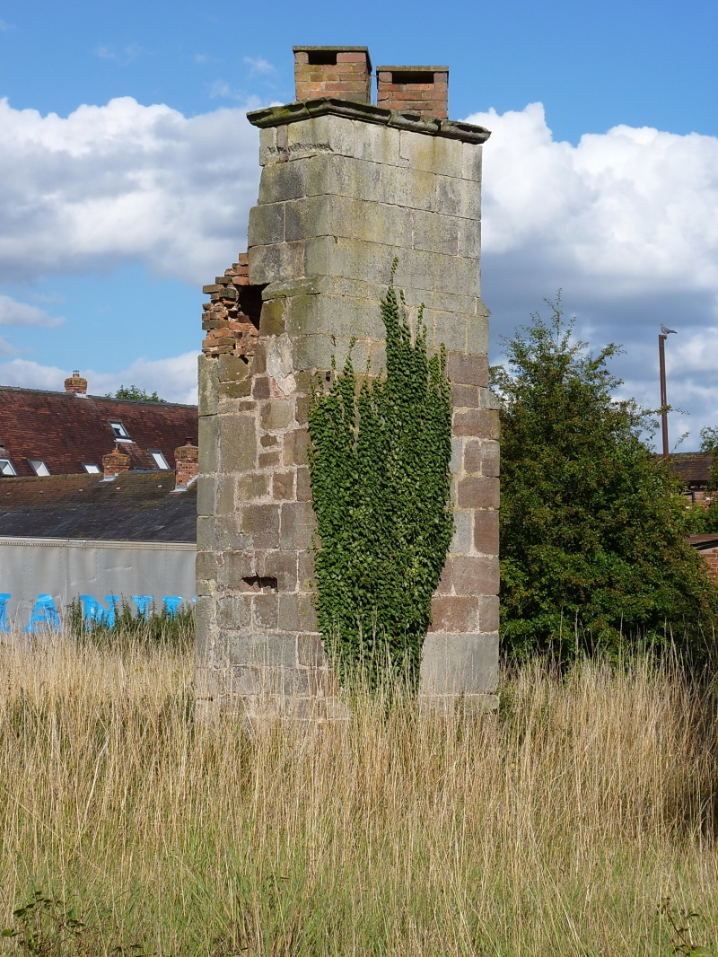
All that remains of Rodington Hall is 2-storeys of a chimney stack. Appears to
be C16. Sandstone ashlar with Tudor arched fireplace to ground floor and remains
of fireplace above. Rodington Hall is said to have burnt down in C19 and these
remains stand isolated in a field.
Listing NGR: SJ5905314267
External links are from the relevant listing authority and, where applicable, Wikidata. Wikidata IDs may be related buildings as well as this specific building. If you want to add or update a link, you will need to do so by editing the Wikidata entry.


Other nearby listed buildings
