Latitude: 51.449 / 51°26'56"N
Longitude: -2.5964 / 2°35'46"W
OS Eastings: 358654
OS Northings: 172387
OS Grid: ST586723
Mapcode National: GBR C7M.RF
Mapcode Global: VH88M.YV83
Plus Code: 9C3VCCX3+HF
Entry Name: Hand Crane at Mud Dock
Listing Date: 18 February 1972
Last Amended: 30 December 1994
Grade: II
Source: Historic England
Source ID: 1209534
English Heritage Legacy ID: 380207
ID on this website: 101209534
Location: Canon's Marsh, Bristol, BS1
County: City of Bristol
Electoral Ward/Division: Central
Parish: Non Civil Parish
Built-Up Area: Bristol
Traditional County: Gloucestershire
Lieutenancy Area (Ceremonial County): Bristol
Church of England Parish: Bristol St Stephen with St James and St John the Baptist with St Michael and St George
Church of England Diocese: Bristol
Tagged with: Crane
BRISTOL
ST5872 PRINCE STREET, Floating Harbour 901-1/42/1305 (East side) 18/02/72 Hand crane at Mud Dock (Formerly Listed as: FLOATING HARBOUR Hand crane at Mud Dock)
GV II
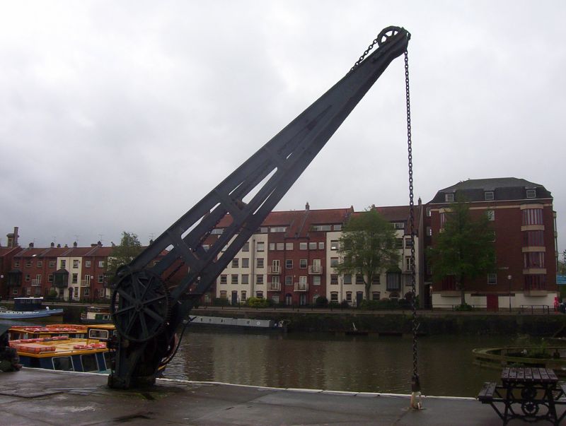
Crane. c1886. Cast-iron. Small hand-operated crane with an open framework jib, gears for lifting and swivelling and pintle-type bearing. On the site of Bristol's Great Crane, one of the wonders of the Docks in the C18. (Lord J and Southam J: The Floating Harbour: Bristol: 1983-: 57).
Listing NGR: ST5865472387
External links are from the relevant listing authority and, where applicable, Wikidata. Wikidata IDs may be related buildings as well as this specific building. If you want to add or update a link, you will need to do so by editing the Wikidata entry.


Other nearby listed buildings