Approximate Location Map
Large Map »
Latitude: 52.7278 / 52°43'40"N
Longitude: -2.6359 / 2°38'9"W
OS Eastings: 357153
OS Northings: 314651
OS Grid: SJ571146
Mapcode National: GBR BP.17R5
Mapcode Global: WH9CT.HP1N
Plus Code: 9C4VP9H7+4J
Entry Name: 2, Drury Lane
Listing Date: 8 April 1983
Grade: II
Source: Historic England
Source ID: 1209538
English Heritage Legacy ID: 362387
ID on this website: 101209538
Location: Somerwood, Telford and Wrekin, Shropshire, SY4
County: Telford and Wrekin
Civil Parish: Rodington
Traditional County: Shropshire
Lieutenancy Area (Ceremonial County): Shropshire
Church of England Parish: Rodington St George
Church of England Diocese: Lichfield
Tagged with: Building
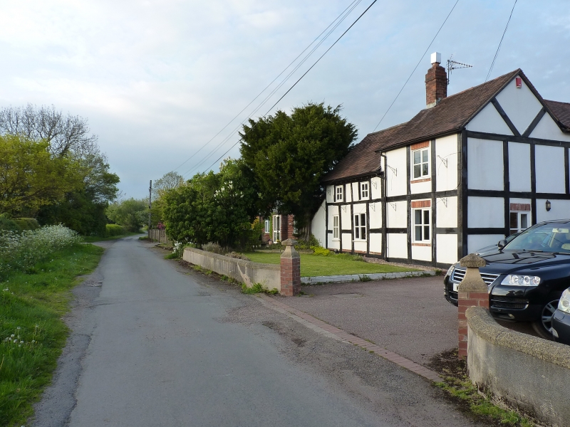
RODINGTON DRURY LANE
1.
5362
No. 2
SJ 51SE 26/534
II
2.
Small late C17 timber framed cottage with whitewashed brick infill panels and
plain tile roof with gabled ends. Two-storeys. Two windows. C19 casements.
C19 brick addition at south end painted to imitate timber framing, one window range.
Listing NGR: SJ5715314651
External links are from the relevant listing authority and, where applicable, Wikidata. Wikidata IDs may be related buildings as well as this specific building. If you want to add or update a link, you will need to do so by editing the Wikidata entry.


Other nearby listed buildings
