Latitude: 53.4005 / 53°24'1"N
Longitude: -2.9739 / 2°58'25"W
OS Eastings: 335345
OS Northings: 389742
OS Grid: SJ353897
Mapcode National: GBR 76Q.PZ
Mapcode Global: WH877.9S3G
Plus Code: 9C5VC22G+6F
Entry Name: 64-72, Rodney Street
Listing Date: 28 June 1952
Last Amended: 19 June 1985
Grade: II
Source: Historic England
Source ID: 1209691
English Heritage Legacy ID: 359353
ID on this website: 101209691
Location: Liverpool, Merseyside, L1
County: Liverpool
Electoral Ward/Division: Riverside
Parish: Non Civil Parish
Built-Up Area: Liverpool
Traditional County: Lancashire
Lieutenancy Area (Ceremonial County): Merseyside
Church of England Parish: St Luke in the City Team
Church of England Diocese: Liverpool
Tagged with: Building
SJ 3589 NW RODNEY STREET (west side) L1
56/1003 Nos. 64 to 72 (even) (formerly listed with Nos. 58 to 28.6.52 62(even)
G.V. II
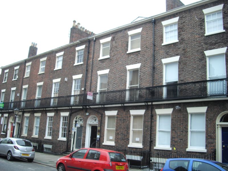
Terrace of 5 houses. Early C19. Brick with stone dressings, slate roof, 2 bays to each house. 1st floor sill band and top cornice. All windows have wedge lintels and are sashed without glazing bars. Round-headed doorways to Nos. 64 to 68 and No. 72; No. 70 has straight-headed entrance with wedge lintel. All have doorcases with foliated capitals to attached columns, Nos. 66 and 68 have complete fanlights. All have 5-panel doors, the lower panel being round. Plain iron area railings and 1st floor balcony. 3 bay left return with mid Cl9 balconies to some windows.
Listing NGR: SJ3534589742
External links are from the relevant listing authority and, where applicable, Wikidata. Wikidata IDs may be related buildings as well as this specific building. If you want to add or update a link, you will need to do so by editing the Wikidata entry.


Other nearby listed buildings