Latitude: 50.3544 / 50°21'15"N
Longitude: -3.5777 / 3°34'39"W
OS Eastings: 287857
OS Northings: 51687
OS Grid: SX878516
Mapcode National: GBR QS.R4G1
Mapcode Global: FRA 38D3.80Y
Plus Code: 9C2R9C3C+QW
Entry Name: Ship in Dock Inn
Listing Date: 23 October 1972
Grade: II
Source: Historic England
Source ID: 1210024
English Heritage Legacy ID: 387319
ID on this website: 101210024
Location: Dartmouth, South Hams, Devon, TQ6
County: Devon
District: South Hams
Civil Parish: Dartmouth
Built-Up Area: Dartmouth
Traditional County: Devon
Lieutenancy Area (Ceremonial County): Devon
Church of England Parish: Dartmouth Townstal
Church of England Diocese: Exeter
Tagged with: Inn
DARTMOUTH
SX8751 RIDGE HILL 673-1/5/204 (South side) 23/10/72 Nos.1 AND 1A Ship in Dock Inn
GV II
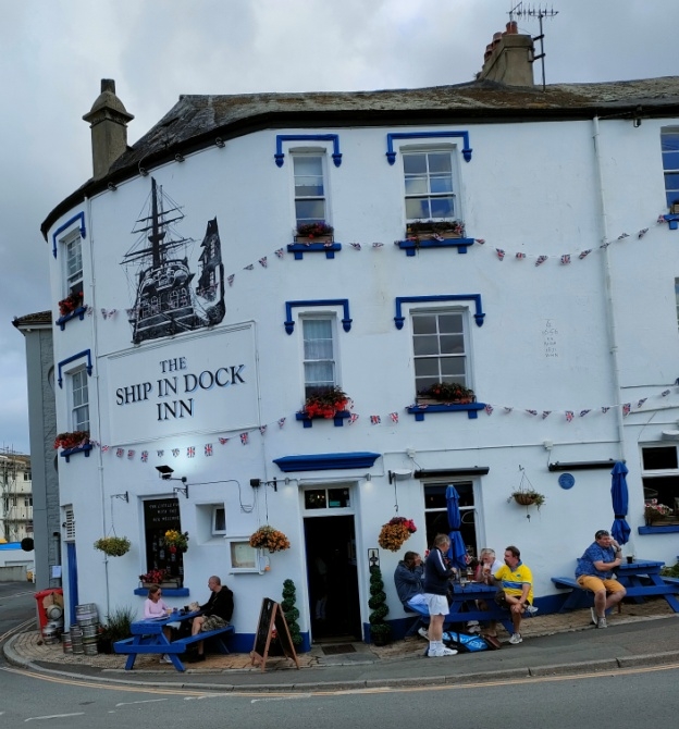
Public house with accommodation over. According to the date plaque there was a house built in 1656 here, but it was rebuilt in 1871. Plastered stone rubble, with front lightly blocked out as ashlar; central axial stack, right end, rear and front lateral stacks with rendered brick chimneyshafts and pots; slate roof. PLAN: Single-depth with a 4-room plan. EXTERIOR: 3 storeys; 4-window range. Sashes of 4/4 panes on the upper floors. Left 2-window section has stucco hoodmoulds with leafy label stops (similar one-window section on the left return onto Clarence Street). House doorway to right of main front has a fielded 6-panel door. Main doorway to left of main front has a fielded 8-panel door and overlight and moulded stucco floating cornice above. Date plaque set between the two 2-window sections at first-floor level, inscribed "E." and "E.C." with the date 1656 above the intials "R.N.", and then "Rebuilt 1871 W.H.N." Roof is gable-ended to right and hipped to left with a broad curve round the corner. INTERIOR: Only partially inspected. The bars are superficially the result of C20 modernisations. The right-hand house stair has stick balusters, and more C19 joinery and other features probably survive on the upper floors.
Listing NGR: SX8785751687
External links are from the relevant listing authority and, where applicable, Wikidata. Wikidata IDs may be related buildings as well as this specific building. If you want to add or update a link, you will need to do so by editing the Wikidata entry.


Other nearby listed buildings