Approximate Location Map
Large Map »
Latitude: 51.4181 / 51°25'5"N
Longitude: -1.5124 / 1°30'44"W
OS Eastings: 434004
OS Northings: 168905
OS Grid: SU340689
Mapcode National: GBR 706.2GF
Mapcode Global: VHC1S.QMT6
Plus Code: 9C3WCF9Q+72
Entry Name: 2, Charnham Street
Listing Date: 8 June 1984
Grade: II
Source: Historic England
Source ID: 1210478
English Heritage Legacy ID: 395086
ID on this website: 101210478
Location: Eddington, West Berkshire, RG17
County: West Berkshire
Civil Parish: Hungerford
Built-Up Area: Hungerford
Traditional County: Wiltshire
Lieutenancy Area (Ceremonial County): Berkshire
Church of England Parish: Hungerford with Denford
Church of England Diocese: Oxford
Tagged with: Building
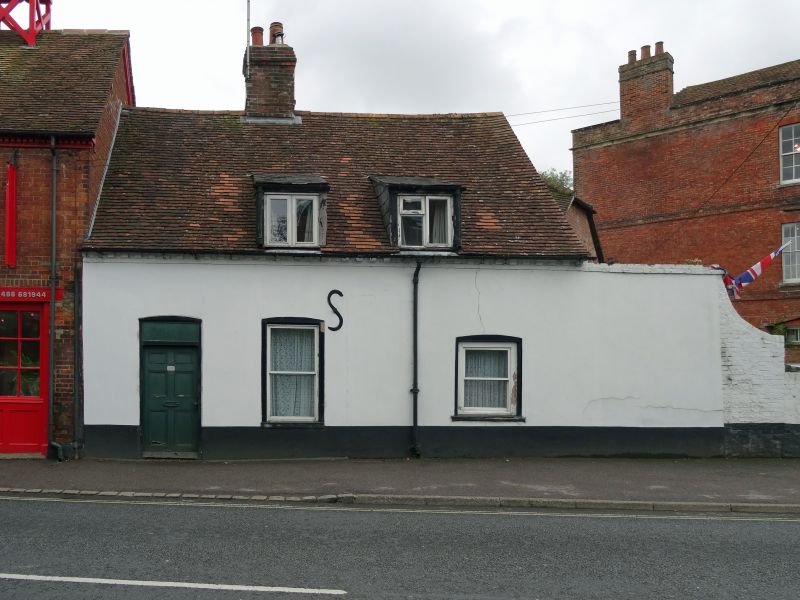
HUNGERFORD CHARNHAM STREET (South Side)
SU 3368
18/55 No.2
G.V. II
Stables, now cottage. Early C19. Tiled roof, central chimney painted render
on brick, brick dentil course to eaves, 2 flat headed dormer. One storey
and attic. 6 panel door with fanlight to left, 2 glazing bar sashes with
cambered heads to right.
Listing NGR: SU3400468905
External links are from the relevant listing authority and, where applicable, Wikidata. Wikidata IDs may be related buildings as well as this specific building. If you want to add or update a link, you will need to do so by editing the Wikidata entry.


Other nearby listed buildings
