Approximate Location Map
Large Map »
Latitude: 51.4117 / 51°24'42"N
Longitude: -1.4957 / 1°29'44"W
OS Eastings: 435167
OS Northings: 168195
OS Grid: SU351681
Mapcode National: GBR 707.DP3
Mapcode Global: VHC1T.1S35
Plus Code: 9C3WCG63+MP
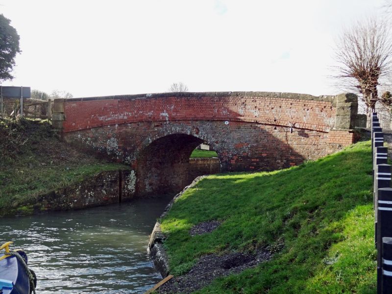
Entry Name: Bridge over Canal at Dun Mill
Listing Date: 8 June 1984
Grade: II
Source: Historic England
Source ID: 1210532
English Heritage Legacy ID: 395162
ID on this website: 101210532
Location: West Berkshire, RG17
County: West Berkshire
Civil Parish: Hungerford
Traditional County: Berkshire
Lieutenancy Area (Ceremonial County): Berkshire
Church of England Parish: Hungerford with Denford
Church of England Diocese: Oxford
Tagged with: Bridge
HUNGERFORD DENFORD
SU 36 NE
12/1 Bridge over Canal at Dun Mill
G.V. II
Canal bridge. Late C18. Brick with stone end piers and capping and band
at road level. Plain single arch with curved brick courses to parapet.
Deep brick lined cut forming end of Lock.
Listing NGR: SU3516768195
External links are from the relevant listing authority and, where applicable, Wikidata. Wikidata IDs may be related buildings as well as this specific building. If you want to add or update a link, you will need to do so by editing the Wikidata entry.


Other nearby listed buildings
