Approximate Location Map
Large Map »
Latitude: 52.2916 / 52°17'29"N
Longitude: -0.3867 / 0°23'11"W
OS Eastings: 510131
OS Northings: 267167
OS Grid: TL101671
Mapcode National: GBR H1N.C1Q
Mapcode Global: VHFPJ.7NYM
Plus Code: 9C4X7JR7+J8
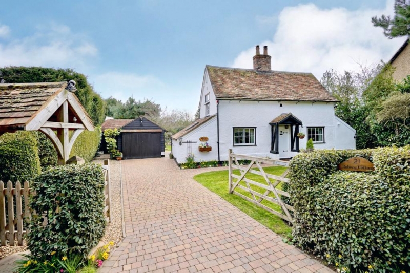
Entry Name: Bodney Cottage
Listing Date: 28 April 1983
Grade: II
Source: Historic England
Source ID: 1210938
English Heritage Legacy ID: 395497
ID on this website: 101210938
Location: Kimbolton, Huntingdonshire, Cambridgeshire, PE19
County: Cambridgeshire
District: Huntingdonshire
Civil Parish: Kimbolton
Built-Up Area: Stonely
Traditional County: Huntingdonshire
Lieutenancy Area (Ceremonial County): Cambridgeshire
Church of England Parish: Kimbolton St Andrew
Church of England Diocese: Ely
Tagged with: Cottage
KIMBOLTON PARK LANE
TL 1067-1167
(SOUTH-EAST SIDE)
7/20 NO. 21 (BODNEY COTTAGE)
GV II
C18 cottage, timber-framed and roughcast rendered with brick
foundations and central ridge stack. Plain tile roof. One-
storey and attic. Two horizontal sliding sash windows with
glazing bars, central plank door.
Listing NGR: TL1013167167
External links are from the relevant listing authority and, where applicable, Wikidata. Wikidata IDs may be related buildings as well as this specific building. If you want to add or update a link, you will need to do so by editing the Wikidata entry.


Other nearby listed buildings
