Latitude: 52.4774 / 52°28'38"N
Longitude: -1.9104 / 1°54'37"W
OS Eastings: 406181
OS Northings: 286611
OS Grid: SP061866
Mapcode National: GBR 5Y9.2S
Mapcode Global: VH9YW.TZXQ
Plus Code: 9C4WF3GQ+XR
Entry Name: 14 and 16, Gas Street B1
Listing Date: 23 September 1981
Grade: II
Source: Historic England
Source ID: 1211058
English Heritage Legacy ID: 217097
ID on this website: 101211058
Location: Birmingham, West Midlands, B1
County: Birmingham
Parish: Non Civil Parish
Built-Up Area: Birmingham
Traditional County: Warwickshire
Lieutenancy Area (Ceremonial County): West Midlands
Church of England Parish: Birmingham St Luke
Church of England Diocese: Birmingham
Tagged with: Building
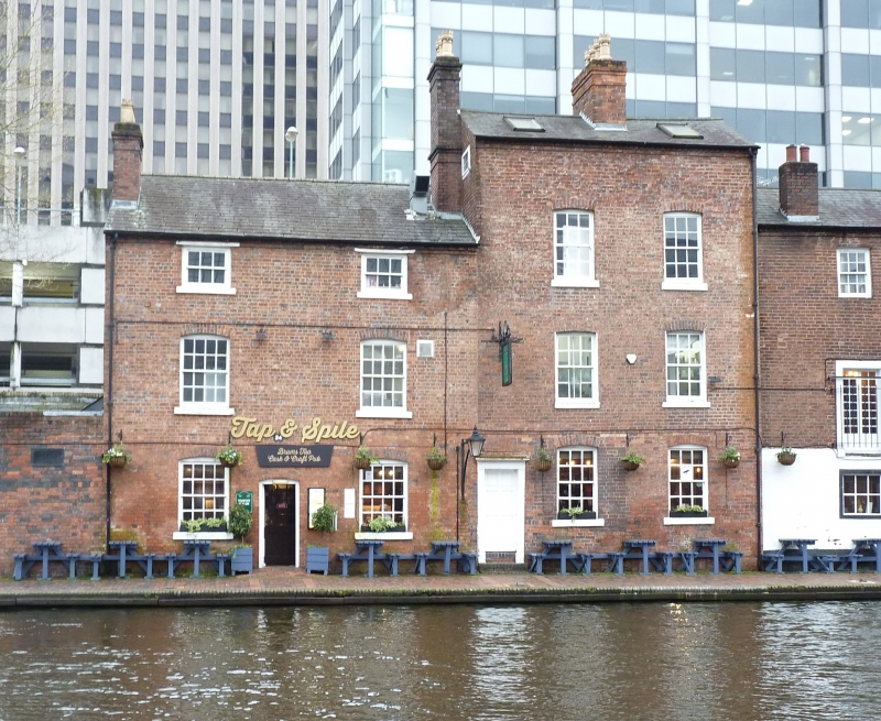
GAS STREET 1. 5104 City Centre B1 Nos 14 and 16 SP 0686 NW 32/13 23.9.81 II GV 2. Early C19, altered. Brick, the ground floors painted. Two storeys; each house 3 bays. No 14. Ground floor with 2 windows and the door up steps and within a modest doorcase with panelled reveals. First floor with 2 windows. All windows sashes with stuccoed cornices on brackets and complete with glazing bars. Dentilled eaves cornice and slate roof. No 16. Ground floor with a simple door and a sash window with stuccoed cornice on brackets. First floor with 2 altered sash windows complete with glazing bars. Parapet. Both properties back on to the canal where they appear 3-storeyed. No 14 has a door up steps within a modest doorcase and segment-headed sash windows all with glazing bars. No 16 has a door and segment headed windows mostly with glazing bars.
Listing NGR: SP0618186611
External links are from the relevant listing authority and, where applicable, Wikidata. Wikidata IDs may be related buildings as well as this specific building. If you want to add or update a link, you will need to do so by editing the Wikidata entry.


Other nearby listed buildings